
Archivo: Arabian Desert
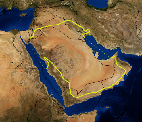
Description: This is a map showing the location of the Arabian Desert. The yellow line encloses ecoregions as delineated by the World Wide Fund for Nature: the "Arabian Desert and East Sahero-Arabian xeric shrublands", and the "Arabian Gulf desert and semi-desert" (a narrow strip along the Persian Gulf coast), and the "Red Sea Nubo-Sindian tropical desert and semi-desert" (along the Red Sea and in patches throughout the Arabian peninsula). National boundaries are shown in black. I, Pfly, made it using NASA Blue Marble imagery and ecoregion GIS data which I simplified and digitized in Photoshop. WWF code PA1303
Title: Arabian Desert
Credit: NASA, plus my additions by myself.
Author: Pfly
Usage Terms: Public domain
License: Public domain
Attribution Required?: No
Usos del archivo
La siguiente página enlaza a este archivo:
