
Archivo: Africa satellite plane
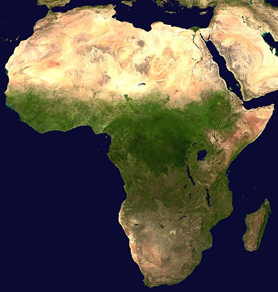
Descripción: A composed satellite photograph of Africa.
Título: Africa satellite plane
Créditos: The image is from [1] ("Blue Marble: Land Surface, Shallow Water, and Shaded Topography ", 2002). I took the two 21600x21600 images, land_shallow_topo_west.tif and land_shallow_topo_east.tif, and composed them. I cropped the resulting image at 8460x8900+19400+6200. Regarding the source data of the original, NASA-Blue Marble file, it is being explained [2] that it used a set of satellite-based observations to yield an image with 1 km² (0.386 square mile) resolution most information comes from NASA’s MODIS instrument (Moderate Resolution Imaging Spectroradiometer) data were collected from June through September 2001 ocean data has two sources: (i) shallow water true color data, and (ii) global ocean color/chlorophyll data elevation data stem from the GTOPO 30 dataset by the U.S. Geological Survey’s EROS Data Center
Autor(a): NASA
Términos del Uso: Public domain
Licencia: Public domain
¿Se exige la atribución?: No
Usos del archivo
La siguiente página enlaza a este archivo:
