
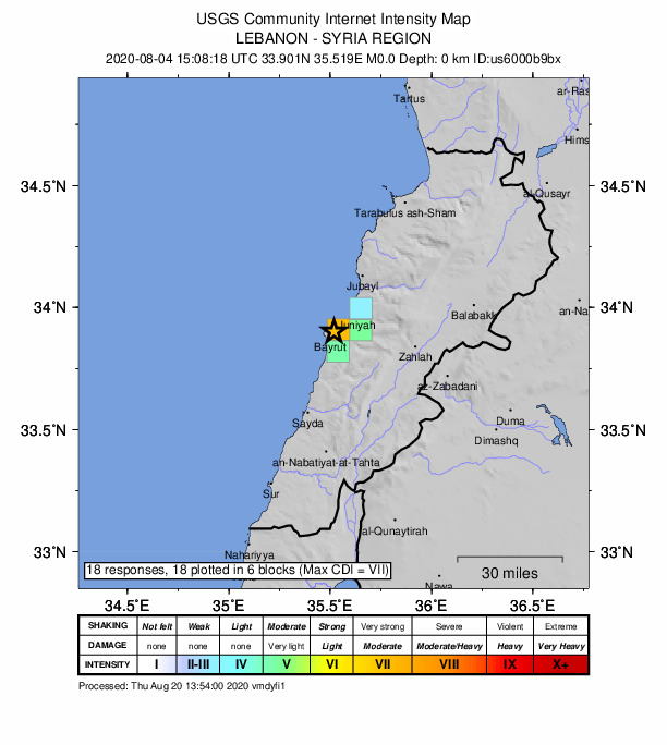
Archivo: 2020-08-04 Beirut, Lebanon M3.3 explosion intensity map (USGS)
Descripción: Intensity map from USGS for the magnitude 3.3 explosion (1km ENE of en:Beirut, Lebanon). The Beirut, Lebanon explosion was processed using the same basic methods that we use for regional earthquakes. To remove uncertainties in the location associated with seismic methods, we fix the location to the location seen in videos of the blast. Standard methods were used to calculate the magnitude. The reported magnitude is not directly comparable to an earthquake of similar size because the explosion occurred at the surface where seismic waves are not as efficiently generated.
Título: 2020-08-04 Beirut, Lebanon M3.3 explosion intensity map (USGS)
Créditos: https://earthquake.usgs.gov/earthquakes/eventpage/us6000b9bx/dyfi/intensity
Autor(a): Servicio Geológico de los Estados Unidos
Términos de Uso: Dominio Público
Licencia: Dominio Público
¿Se exige la atribución?: No
Usos del archivo
La siguiente página enlaza a este archivo:
.jpg&oldid=3033956)

.jpg)