
Archivo: 20170809 Bolivia 1521 Uyuni sRGB (37926739616)
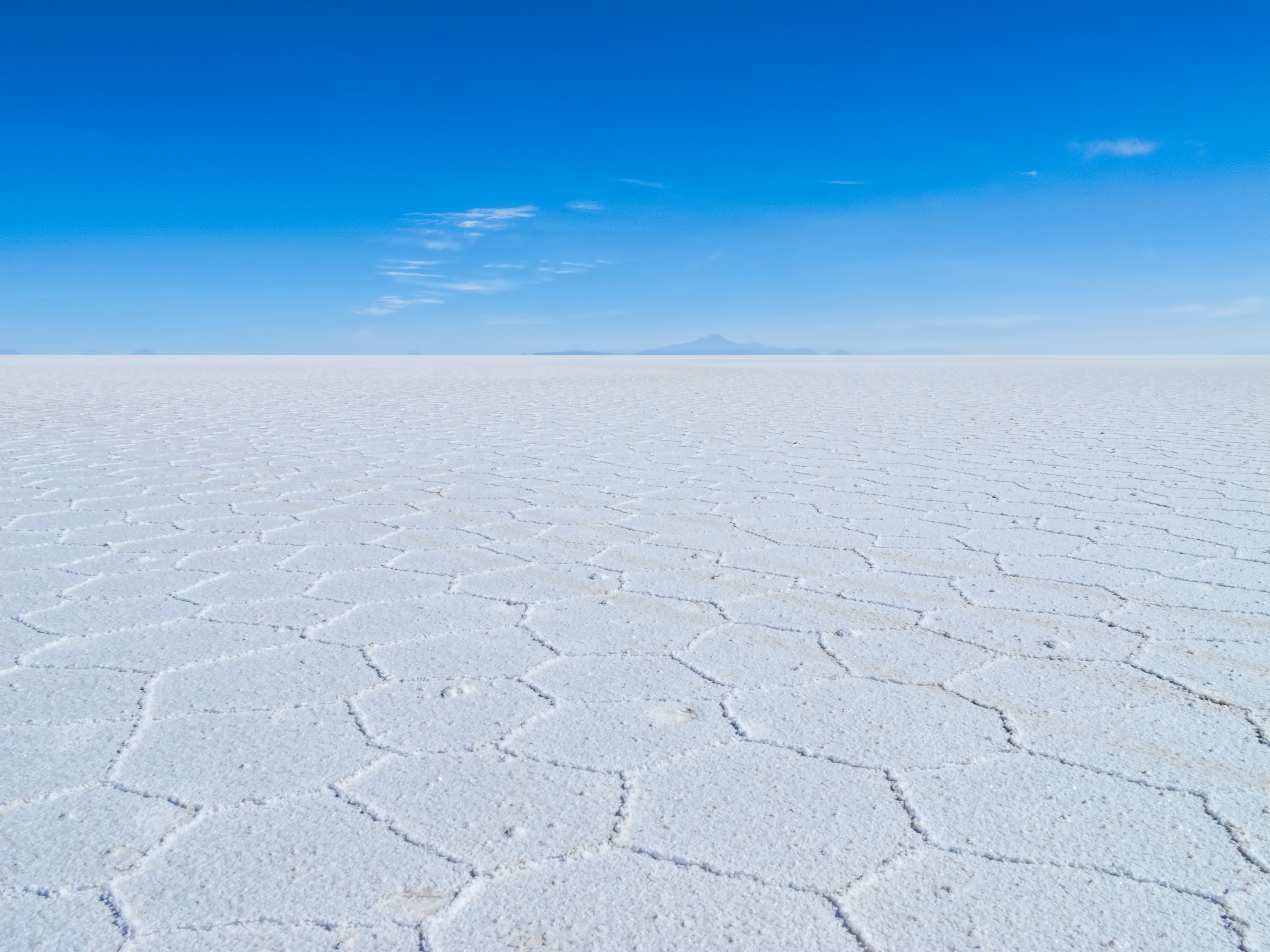
Descripción: During the rainy season (December to March) the salt flat gets covered with a layer of water. As the water evaporates under largely still conditions, the salt forms hexagonal shapes (optimal for heat transfer) on its surface known as Bénard cells, an example of the Rayleigh–Bénard convection phenomena. On the horizon is conical Tunupa Volcano (5,321m/17,457ft), an important point of reference when navigating the salt flat. One legend holds that Tunupa is a female volcano whose child was stolen and her tears created the salt flat. The Uyuni Salt Flat is the world’s largest salt flat covering 10,582 sq km/4,086 sq mi (100 times the size of the Bonneville Salt Flats in Utah in the United States). Part of the Bolivian Altiplano (high plateau), the Uyuni Salt Flat sits at an elevation of 3,656m/11,995ft surrounded by the Andes mountains. It is the bed of a series of vast lakes that once covered the area starting around 40,000 years ago, the last of which was radiocarbon dated to 11,500 to 13,400 years ago. In November, three species of South American flamingos breed here. The crust, which varies in thickness from tens of centimeters to a few meters, is a source of salt. Underneath is a pool of brine rich in lithium which Bolivia is just starting to extract. (Bolivia is the holder of the world’s largest known lithium reserves.) On Google Earth: Salar de Uyuni 20°19'57.27"S, 66°59'51.09"W Volcán Tunupa 19°50'26.30"S, 67°38'30.01"W
Título: 20170809 Bolivia 1521 Uyuni sRGB (37926739616)
Créditos: 20170809_Bolivia_1521 Uyuni sRGB
Autor(a): Dan Lundberg
Términos de Uso: Creative Commons Attribution-Share Alike 2.0
Licencia: CC BY-SA 2.0
Enlace de Licencia: https://creativecommons.org/licenses/by-sa/2.0
¿Se exige la atribución?: Sí
Usos del archivo
La siguiente página enlaza a este archivo:
.jpg&oldid=4863081)

.jpg)