Archivo: 2010 Meager debris flow
2010_Meager_debris_flow.jpg (324 × 441 píxeles; tamaño de archivo: 12 KB; tipo MIME: image/jpeg)
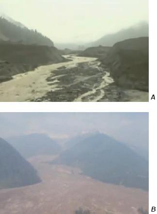
Description: River valleys filled with debris from 2010 landslide of the Mount Meager massif. Aerial views of the collapsed debris dam near the intersection of Capricorn Creek and Meager Creek (A) and the debris flow at the junction of Meager Creek and the Lillooet River.
Title: 2010 Meager debris flow
Credit: Own work
Author: Black Tusk
Usage Terms: Creative Commons Attribution 3.0
License: CC BY 3.0
License Link: http://creativecommons.org/licenses/by/3.0
Attribution Required?: Yes
Usos del archivo
La siguiente página enlaza a este archivo:

Todo el contenido de los artículos de la Enciclopedia Kiddle (incluidas las imágenes) se puede utilizar libremente para fines personales y educativos bajo la licencia Atribución-CompartirIgual a menos que se indique lo contrario.

