
Archivo: 1850 California, Oregon, Utah, New Mexico Map
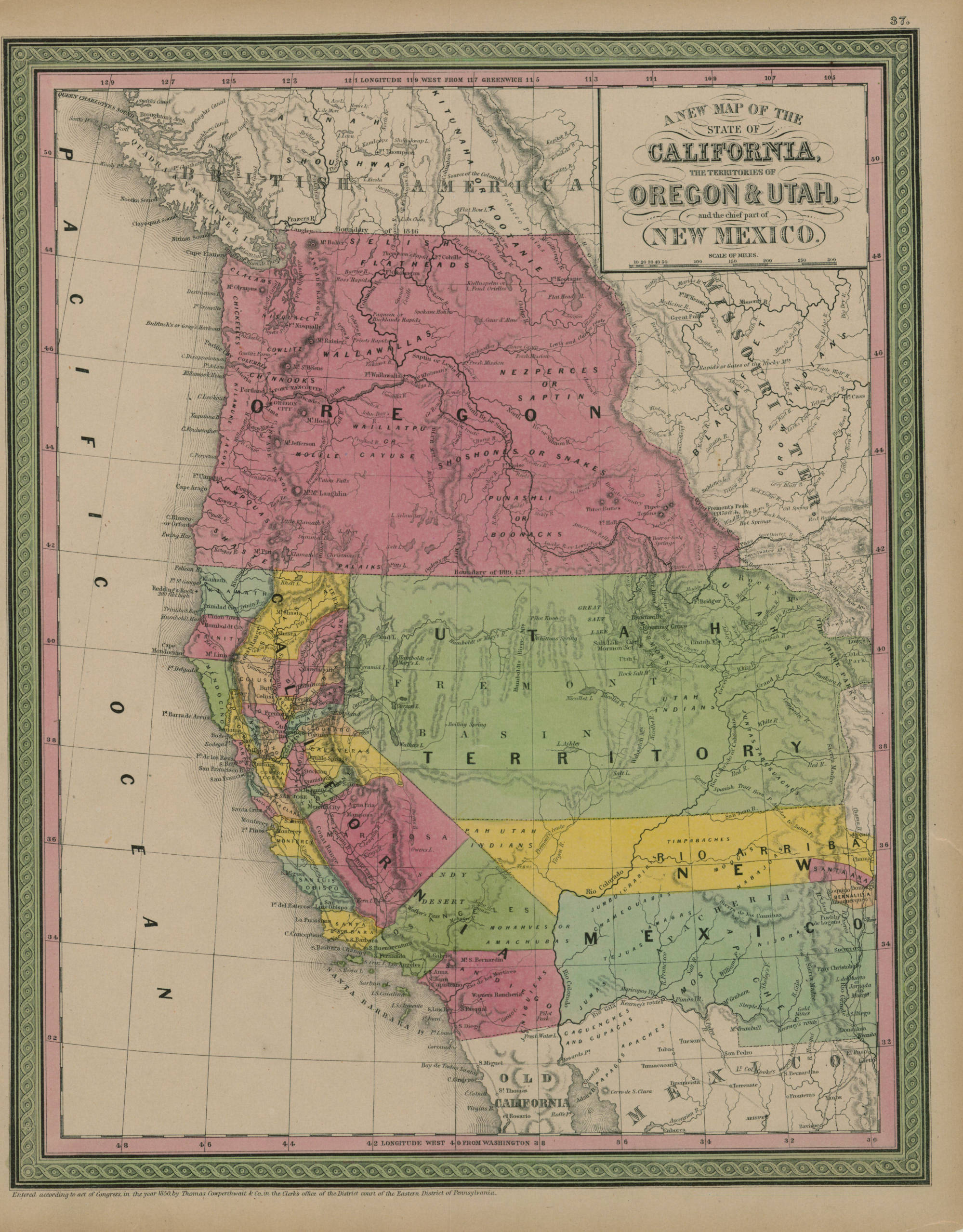
Descripción: 1 map: col., 44 x 35 cm. A hand colored map including the Oregon Territory (pink)--comprising the area that would later split into Washington Territory in 1853. The map also includes the newly formed State of California. Its population boomed following the discovery of gold in 1848 and the rush of 49ers into the area the next year. Note also Utah Territory (green). Worried by the streaming mass of miners coming into the area in 1849, the Mormons invited Europeans interested in their faith (particularly from England) to come and populate Utah. This map, published by Thomas Cowperthwait & Co., may be from an atlas set contracted to him by S. Augustus Mitchell. Cowperthwait began publishing Mitchell's New Universal Atlas in 1850, printing the atlas until 1856. (At that time it was taken over by another well-known mapmaker, Charles DeSilver.) Cowperthwait continued to use Mitchell maps in various forms well into the 1880s. From Washington State University Digital Collections
Título: 1850 California, Oregon, Utah, New Mexico Map
Créditos: https://content.libraries.wsu.edu/digital/collection/maps/id/200
Autor(a): Thomas Cowperthwait & Co.
Términos de Uso: Dominio Público
Licencia: Dominio Público
¿Se exige la atribución?: No
Usos del archivo
La siguiente página enlaza a este archivo:
