
Anexo:Registro Nacional de Lugares Históricos en el condado de Essex para niños
El condado de Essex en Nueva Jersey, Estados Unidos, es un lugar lleno de historia. Aquí te presentamos una lista de sitios especiales que han sido reconocidos por su importancia y están incluidos en el Registro Nacional de Lugares Históricos. Estos lugares nos ayudan a entender cómo era la vida antes y a conservar edificios y espacios que cuentan historias de nuestro pasado.

Contenido
Lugares Históricos Destacados en el Condado de Essex
Edificios y Casas Antiguas
Muchos de los lugares históricos en el condado de Essex son casas y edificios que nos muestran cómo se construía y vivía en otras épocas.
Mansiones y Residencias con Historia
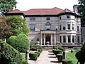
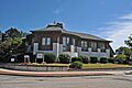
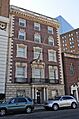
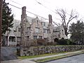
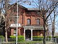
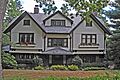
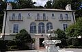
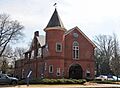
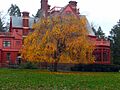
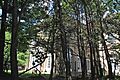
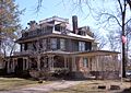
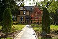
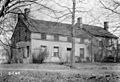
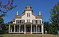
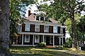
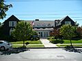
- Ambrose-Ward Mansion: Una hermosa mansión en East Orange, listada en 1982.
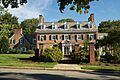
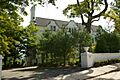
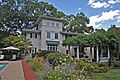
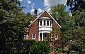
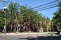
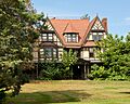
- The Anchorage: Una casa en Montclair, reconocida en 1988.
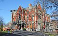
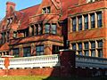
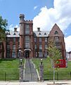
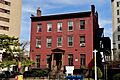
- John Ballantine House: Ubicada en Newark, esta casa es ahora parte del Museo de Newark. Fue listada en 1973.
- Joseph Bardsley House: Otra casa histórica en Montclair, añadida a la lista en 1988.
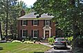
- Canfield-Morgan House: Una casa importante en Cedar Grove, listada en 1995.
- Casa Deldra: Una residencia en Montclair, reconocida en 1988.
- J. M. Chapman House: Una casa en Montclair, listada en 1988.
- William Clark House: Una casa histórica en Newark, añadida en 1977.
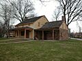
- Collins House: Ubicada en Bloomfield, fue listada más recientemente en 2017.
- Israel Crane House: Una casa y museo en Montclair, reconocida en 1973.
- Eastward: Una propiedad en Montclair, listada en 1988.
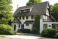
- Egbert Farm: Una granja histórica en Montclair, reconocida en 1988.
- Feigenspan Mansion: Una mansión en Newark, listada en 1977.
- Henry Fenn House: Una casa en Montclair, añadida en 1988.
- Samuel Orton Harrison House: Una casa en West Caldwell, listada en 1980.
- Haskell`s Bloomfield Villa: Una villa en Montclair, reconocida en 1988.
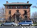
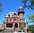
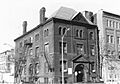
- Krueger Mansion: Una mansión en Newark, listada en 1972.
- Mulford House: Una casa en Montclair, añadida en 1988.
- Charles S. Shultz House: Una casa en Montclair, listada en 1979.
- S.C. Smith House: Otra casa en Montclair, reconocida en 1988.
- Stone Eagles: Una casa en Montclair, listada en 1988.
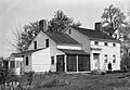
- Stone House by the Stone House Brook: Una casa muy antigua en South Orange, construida antes de 1680, listada en 1991.
- Sydenham House: Una casa histórica en Newark, reconocida en 1970.
- Symington House: Una casa en Newark, listada en 1979.
- Van Ness House: Una casa en Fairfield, añadida en 1977.
- Van Reyper-Bond House: Una casa en Montclair, listada en 1979.
- Von Schmid House: Una casa en Montclair, reconocida en 1988.
- Vreeland Homestead: Una propiedad en Nutley, listada en 1994.
- Ward-Force House and Condit Family Cook House: Una casa en Livingston, añadida en 1981.
- Allyn Wight House: Una casa en Montclair, listada en 1988.
- Williams-Harrison House: Una casa en Roseland, reconocida en 1979.
Edificios Residenciales y Comerciales
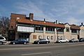
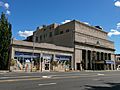
- Bradner`s Pharmacy: Una farmacia histórica en Montclair, listada en 1988.
- Griffith Building: Un edificio en Newark, reconocido en 1984.
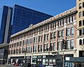
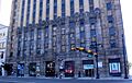
- Hahne and Company: Un edificio comercial en Newark, listado en 1994.
- Home Office Building: Un edificio de oficinas en Newark, añadido en 1982.
- Everett Court Apartments: Apartamentos en Newark, listados en 2021.
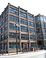
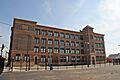
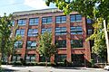
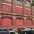
- Interstate Hosiery Mills, Inc. Mill Building: Un edificio industrial en Bloomfield, reconocido en 2009.
- Murphy Varnish Works: Una antigua fábrica en Newark, listada en 1979.
- Mutual Benefit Life Insurance Company: Un edificio de seguros en Newark, añadido en 1983.
- New Jersey Bell Headquarters Building: La sede de una compañía telefónica en Newark, reconocida en 2005.
Lugares de Culto y Educación
El condado de Essex también tiene iglesias y escuelas antiguas que son importantes por su arquitectura y su papel en la comunidad.
Iglesias y Catedrales Históricas
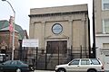
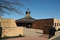
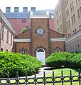
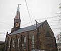
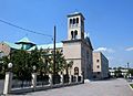
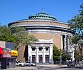
- Ahavas Sholom: Una sinagoga en Newark, ahora el Museo Judío de Nueva Jersey, listada en 2000.
- Belleville Avenue Congregational Church: Una iglesia en Newark, reconocida en 1986.
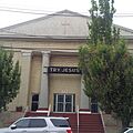
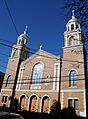
- Bethany Baptist Church: Una iglesia en Newark, listada en 1989 (la iglesia original fue demolida).
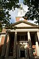
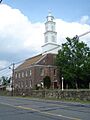
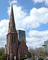
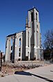
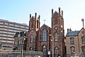
- Catedral Evangélica Reformada: Una catedral en Newark, añadida en 1972.
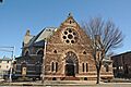
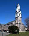
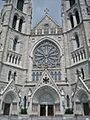
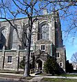
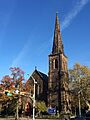
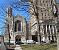
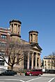
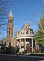
- Cathedral Basilica of the Sacred Heart: Una gran catedral en Newark, reconocida en 1976.
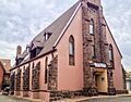
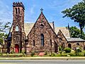
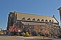
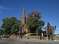
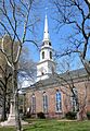
- Central Presbyterian Church: Una iglesia en Montclair, listada en 1986.
- Congregational Church: Una iglesia en Montclair, añadida en 1988.
- Fairfield Dutch Reformed Church: Una iglesia en Fairfield, reconocida en 1975.
- First Baptist Peddie Memorial Church: Una iglesia en Newark, listada en 1972.
- First Methodist Episcopal Church: Una iglesia en Montclair, añadida en 1988.
- Grace Church: Una iglesia en Newark, reconocida en 1972.
- House of Prayer Episcopal Church and Rectory: Una iglesia en Newark, listada en 1972.
- New Point Baptist Church: Una iglesia en Newark, añadida en 1972.
- North Reformed Church: Una iglesia en Newark, reconocida en 1972.
- Old First Presbyterian Church: Una iglesia en Newark, listada en 1972.
- Pan American C.M.A. Church: Una iglesia en Newark, añadida en 1972.
- Queen of Angels Church: Una iglesia en Newark, reconocida en 1972.
- Reformed Dutch Church of Second River: Una iglesia en Belleville, listada en 1978.
- Second Reformed Dutch Church: Una iglesia en Newark, añadida en 1979.
- South Park Calvary United Presbyterian Church: Una iglesia en Newark, reconocida en 1972.
- St. Barnabas' Episcopal Church: Una iglesia en Newark, listada en 1972.
- St. Casimir's Roman Catholic Church: Una iglesia en Newark, añadida en 1997.
- St. Columba's Church: Una iglesia en Newark, reconocida en 1972.
- St. James' A. M. E. Church: Una iglesia en Newark, listada en 1972.
- St. John's Church: Una iglesia en Newark, añadida en 1972.
- St. Joseph's Roman Catholic Church Rectory and School: Una iglesia y escuela en Newark, reconocida en 1980.
- St. Lucy's Church: Una iglesia en Newark, listada en 1998.
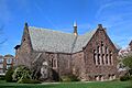
- St. Luke's Church: Una iglesia en Montclair, añadida en 1988.
- St. Mark's Episcopal Church: Una iglesia en West Orange, reconocida en 1977.
- St. Mary's Abbey Church: Una iglesia en Newark, listada en 1972.
- St. Patrick's Pro Cathedral: Una catedral en Newark, añadida en 1972.
- St. Rocco's Roman Catholic Church: Una iglesia en Newark, reconocida en 1980.
- St. Stephan's Church: Una iglesia en Newark, listada en 1972.
- Temple B'Nai Abraham: Un templo en Newark, añadido en 2007.
- Trinity Cathedral: Una catedral en Newark, reconocida en 1972.
- Wickcliffe Presbyterian Church: Una iglesia en Newark, listada en 1978.
Escuelas y Bibliotecas Antiguas
- Church Street School: Una escuela en Nutley, listada en 1995.
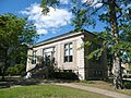
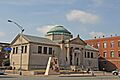
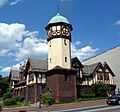
- Carnegie Library: Una biblioteca en Montclair, reconocida en 1988.
- Day Street Public School: Una escuela pública en Orange, añadida en 2012.
- Eighteenth Avenue School: Una escuela en Newark, listada en 2015.
- Free Public Library, Upper Montclair Branch: Una biblioteca en Montclair, reconocida en 1988.
- Maple Avenue School: Una escuela en Newark, listada en 2020.
- Newark Orphan Asylum: Un antiguo orfanato en Newark, listado en 1973.
- Orange Free Public Library: Una biblioteca en Orange, reconocida en 1981.
- State Street Public School: Una escuela en Newark, añadida en 1990.
Parques y Distritos Históricos
Además de edificios individuales, hay áreas completas que son importantes por su historia y diseño.
Parques y Jardines Históricos
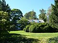
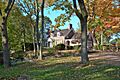
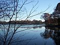
- Anderson Park: El primer parque en el primer sistema de parques del condado en el país, ubicado en Montclair y listado en 2009.
- Branch Brook Park: Un gran parque en Newark y Belleville, reconocido en 1981.
- Maplewood Memorial Park: Un parque en Maplewood, listado en 2015.
- Military Park Commons Historic District: Un parque en Newark, reconocido en 2004.
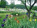
- Presby Memorial Iris Gardens Horticultural Center: Un jardín de iris en Montclair, listado en 1980.
- Riverbank Park: Un parque en Newark, añadido en 1998.
- Weequahic Park Historic District: Un parque en Newark, reconocido en 2003.
Distritos Históricos
Estos distritos son áreas con varios edificios o elementos que juntos cuentan una historia.
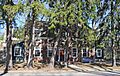
- Bloomfield Green Historic District: Un distrito en Bloomfield, listado en 1978.
- Central Avenue Commercial Historic District: Un distrito comercial en East Orange, reconocido en 1983.
- Enclosure Historic District: Un distrito en Nutley, añadido en 1974.
- Forest Hill Historic District: Un distrito en Newark, listado en 1990.
- Four Corners Historic District: Un distrito en Newark, reconocido en 2000.
- Glen Ridge Historic District: Un distrito en Glen Ridge, listado en 1982.
- James Street Commons Historic District: Un distrito en Newark, añadido en 1978.
- Lincoln Park Historic District: Un distrito en Newark, reconocido en 1984.
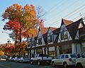
- Llewellyn Park Historic District: Un distrito en West Orange, listado en 1986.
- Marlboro Park Historic District: Un distrito en Montclair, añadido en 1988.
- Miller Street Historic District: Un distrito en Montclair, reconocido en 1988.
- Montrose Park Historic District: Un distrito en South Orange, listado en 1997.
- Mountain District: Un distrito en Montclair, añadido en 1988.
- North Broad Street Historic District: Un distrito en Newark, reconocido en 1996.
- Orange Memorial Hospital Historic District: Un distrito hospitalario en Orange, listado en 2015.
- Pine Street Historic District: Un distrito en Montclair, añadido en 2000.
- Short Hills Park Historic District: Un distrito en Millburn, reconocido en 1980.
Estaciones de Tren y Otros Lugares de Interés
El condado de Essex también tiene estaciones de tren antiguas y otros sitios únicos que son parte de su patrimonio.
Estaciones de Tren Históricas
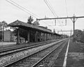
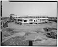
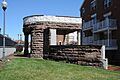
- Ampere Station: Una estación en East Orange, listada en 1984 (cerrada y demolida en 1991).
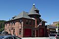
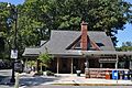
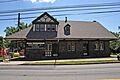
- Bloomfield Station: Una estación en Bloomfield, reconocida en 1984.
- Brick Church Station: Una estación en East Orange, añadida en 1984.
- East Orange Station: Una estación en East Orange, listada en 1984.
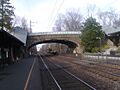
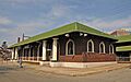
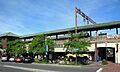
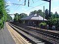
- Montclair Railroad Station: Una estación en Montclair, reconocida en 1973.
- Mountain Avenue Station: Una estación en Upper Montclair, añadida en 1984.
- Mountain Station: Una estación en South Orange, listada en 1984.
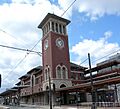
- Newark Broad Street Station: Una estación en Newark, reconocida en 1984.
- Orange Station: Una estación en Orange, añadida en 1984.
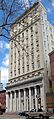
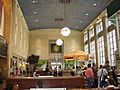
- Pennsylvania Station: Una estación importante en Newark, listada en 1978.
- Upper Montclair Station: Una estación en Upper Montclair, reconocida en 1984.
- Watchung Avenue Station: Una estación en Montclair, añadida en 1984.
Otros Sitios Históricos
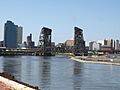
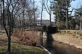
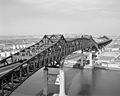
- Dock Bridge: Un puente sobre el río Passaic en Newark, listado en 1980.
- East Orange VA Hospital: Un hospital en East Orange, reconocido en 2018.
- Edison National Historic Site: Un sitio histórico nacional en West Orange, relacionado con Thomas Edison, listado en 1966.
- Edison Storage Battery Company Building: Un edificio de la compañía de baterías de Edison en West Orange, añadido en 1996.
- Essex Club: Un club en Newark, reconocido en 1991.
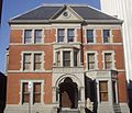
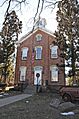
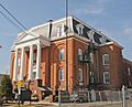
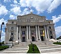
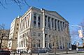
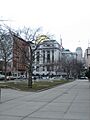
- Essex County Courthouse: El palacio de justicia del condado en Newark, listado en 1975.
- Essex County Jail: La antigua cárcel del condado en Newark, añadida en 1991.
- Essex County Park Commission Administration Building: El edificio de administración de parques en Newark, reconocido en 1977.
- Evergreen Cemetery: Un cementerio en Newark, listado en 1991.
- Glencoe: Un lugar en Newark, añadido en 1991.
- Community Hospital: Un hospital en Newark, reconocido en 2004.
- Eugene V. Kelly Carriage House: Un edificio histórico en el campus de la Universidad Seton Hall en South Orange, listado en 1975.
- Kingsland Manor: Una mansión en Nutley, añadida en 1978.
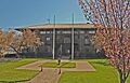
- Maplewood Municipal Building: El edificio municipal de Maplewood, reconocido en 2014.
- Morris Canal: Un antiguo canal que atraviesa varias ciudades, listado en 1974.
- Mount Pleasant Cemetery: Un cementerio en Newark, añadido en 1988.
- Newark Ciudad Hall: El ayuntamiento de Newark, reconocido en 1978.
- Newark Female Charitable Society: Un edificio de una sociedad de caridad en Newark, listado en 1979.
- Newark Metropolitan Airport Buildings: Edificios del aeropuerto en Newark, añadidos en 1980.
- Passaic Machine Works-Watts, Campbell & Company: Una antigua fábrica en Newark, reconocida en 1986.
- Post Office Building, Upper Montclair: La oficina de correos en Upper Montclair, listada en 1988.
- Protestant Foster Home: Un antiguo hogar de acogida en Newark, añadido en 1986.
- Route 1 Extension: Una extensión de carretera que incluye el Pulaski Skyway, listada en 2005.
- Salaam Temple: Un templo en Newark, que luego se convirtió en el Newark Symphony Hall, reconocido en 1977.
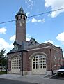
- South Orange Fire Department: La estación de bomberos de South Orange, listada en 1998.
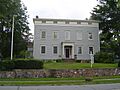
- South Orange Village Hall: El ayuntamiento de South Orange, añadido en 1976.
- Stanley Theater: Un teatro en Newark, reconocido en 1986.
- The House that Lives: Una casa en Montclair, listada en 1988.
- Woman's Club of Upper Montclair: Un club de mujeres en Montclair, añadido en 2012.
Esculturas Públicas
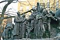
- Indian and the Puritan: Una escultura en Newark, listada en 1994.
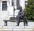
- Seated Lincoln: Una escultura de Abraham Lincoln en Newark, reconocida en 1995.
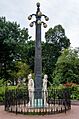
- Wars of America: Una escultura en Military Park, Newark, añadida en 1994.
Galería de imágenes
-
Ahavas Sholom
-
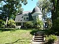
Ambrose-Ward Mansion
-
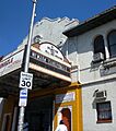
Ampere Station
-
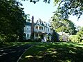
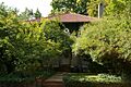
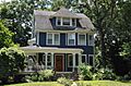
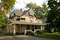
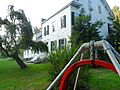
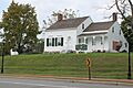
The Anchorage
-
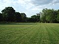
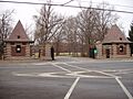
Anderson Park
-
John Ballantine House
-
Joseph Bardsley House
-
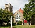
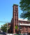
Belleville Avenue Congregational Church
-
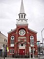
Bethany Baptist Church
-
Bloomfield Green Historic District
-
Bloomfield Station
-
Bradner`s Pharmacy
-
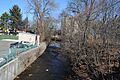
Branch Brook Park
-
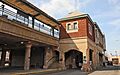
Brick Church Station
-
Caldwell Presbyterian Church Manse
-
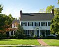
Canfield-Morgan House
-
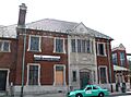
Carnegie Library
-
Casa Deldra
-
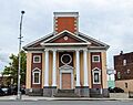
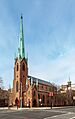
Catedral Evangélica Reformada
-
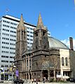
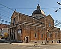
Cathedral of the Sacred Heart
-
Central Avenue Commercial Historic District
-
Central Presbyterian Church
-
J. M. Chapman House
-
Church Street School
-
William Clark House
-
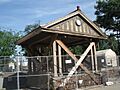
Cliffside Hose Company No. 4
-
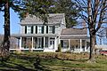
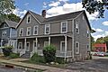
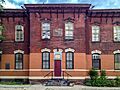
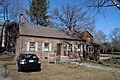
Collins House
-
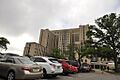
Community Hospital
-
Congregational Church
-
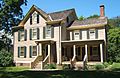
Israel Crane House
-
Day Street Public School
-
Dock Bridge
-
East Orange Station
-
East Orange VA Hospital
-
Eastward
-
Edison National Historic Site
-
Edison Storage Battery Company Building
-
Egbert Farm
-
Eighteenth Avenue School
-
Enclosure Historic District
-
Essex Club
-
Essex County Courthouse
-
Essex County Jail
-
Essex County Park Commission Administration Building
-
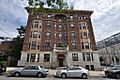
The Everett Court Apartments
-
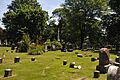
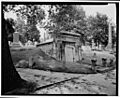
Evergreen Cemetery
-
Fairfield Dutch Reformed Church
-
Feigenspan Mansion
-
Henry Fenn House
-
First Baptist Peddie Memorial Church
-
First Methodist Episcopal Church
-
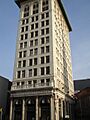
First National State Bank Building
-
Forest Hill Historic District
-
Four Corners Historic District
-
Free Public Library, Upper Montclair Branch
-
Glen Ridge Historic District
-
Glencoe
-
Frank Goodwillie House
-
Grace Church
-
Griffith Building
-
Hahne and Company
-
Samuel Orton Harrison House
-
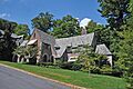
Haskell`s Bloomfield Villa
-
Home Office Building
-
House at 147 Park Street
-
House at 18 Brunswick Road
-
House at 21 Stonebridge Road
-
House at 52 Wayside Place
-
House at 53 Lloyd Road
-
House at 67 Warren Place
-
House at 68 Eagle Rock Way
-
House at 7 South Mountain Terrace
-
House at 80 Lloyd Road
-
House at 97 Warren Place
-
House of Prayer Episcopal Church and Rectory
-
The House that Lives
-
Indian and the Puritan
-
Interstate Hosiery Mills, Inc. Mill Building
-
Jacobus House
-
James Street Commons Historic District
-
Eugene V. Kelly Carriage House
-
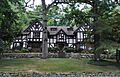
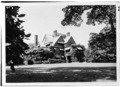
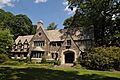
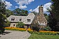
Kingsland Manor
-
Krueger Mansion
-
Lincoln Park Historic District
-
Llewellyn Park Historic District
-
Maple Avenue School
-
Maplewood Memorial Park
-
Maplewood Municipal Building
-
Marlboro Park Historic District
-
Marsellis House
-
Military Park Commons Historic District
-
Miller Street Historic District
-
George A. Miller House
-
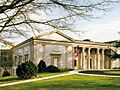
Montclair Art Museum
-
Montclair Railroad Station
-
Montrose Park Historic District
-
Morris Canal
-
Mount Pleasant Cemetery
-
Mountain Avenue Station
-
Mountain Station
-
Mulford House
-
Murphy Varnish Works
-
Mutual Benefit Life Insurance Company
-
New Jersey Bell Headquarters Building
-
New Point Baptist Church
-
Newark Broad Street Station
-
Newark Ciudad Hall
-
Newark Female Charitable Society
-
Newark Metropolitan Airport Buildings
-
Newark Orphan Asylum
-
North Broad Street Historic District
-
North Reformed Church
-
Oakes Estate
-
Old First Presbyterian Church
-
Orange Free Public Library
-
Orange Memorial Hospital Historic District
-
Orange Station
-
Pan American C.M.A. Church
-
Passaic Machine Works-Watts, Campbell & Company
-
Pennsylvania Station
-
Pine Street Historic District
-
Post Office Building, Upper Montclair
-
Presby Memorial Iris Gardens Horticultural Center
-
Protestant Foster Home
-
Queen of Angels Church
-
M. F. Reading House
-
Red Gables
-
Reformed Dutch Church of Second River
-

Riverbank Park
-
Route 1 Extension
-
Salaam Temple
-
Charles S. Shultz House
-
Seated Lincoln
-
Second Reformed Dutch Church
-
Short Hills Park Historic District
-
S.C. Smith House
-
South Orange Fire Department
-
South Orange Station
-
South Orange Village Hall
-
South Park Calvary United Presbyterian Church
-
St. Barnabas' Episcopal Church
-
St. Casimir's Roman Catholic Church
-
St. Columba's Church
-
St. James' A. M. E. Church
-
St. John's Church
-
St. Joseph's Roman Catholic Church Rectory and School
-
St. Lucy's Church
-
St. Luke's Church
-
St. Mark's Episcopal Church
-
St. Mary's Abbey Church
-
St. Patrick's Pro Cathedral
-
St. Rocco's Roman Catholic Church
-
St. Stephan's Church
-
Stanley Theater
-
State Street Public School
-
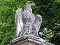
Stone Eagles
-
Stone House by the Stone House Brook
-
Sydenham House
-
Symington House
-
Temple B'Nai Abraham
-
Trinity Cathedral
-
Upper Montclair Station
-
Van Ness House
-
Van Reyper-Bond House
-
Von Schmid House
-
Vreeland Homestead
-
Ward-Force House and Condit Family Cook House
-
Wars of America
-
Watchung Avenue Station
-
Weequahic Park Historic District
-
Wickcliffe Presbyterian Church
-
Allyn Wight House
-
Williams-Harrison House
-
Woman's Club of Upper Montclair


.jpg)


,_N._Fulton_St.,_Bloomfield,_New_Jersey.JPG)


.jpg)


Véase también
 En inglés: National Register of Historic Places listings in Essex County, New Jersey Facts for Kids
