
Archivo: Wichita-Winfield CSA
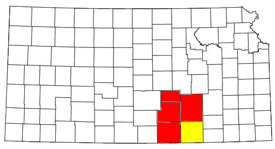
Description: Locator map of the Wichita-Winfield Combined Statistical Area in the southern part of the U.S. state of Kansas. The two components of the CSA are colored separately: Wichita Metropolitan Statistical Area: red Winfield Micropolitan Statistical Area: yellow
Title: Wichita-Winfield CSA
Credit: Modified from this United States Census Bureau file, based on the following Census definitions lists: Metropolitan Statistical Areas Micropolitan Statistical Areas Combined Statistical Areas
Author: User:Nyttend
Permission: US Government work is public domain, and my work is Public domainPublic domainfalsefalse I, the copyright holder of this work, release this work into the public domain. This applies worldwide. In some countries this may not be legally possible; if so: I grant anyone the right to use this work for any purpose, without any conditions, unless such conditions are required by law.
Usage Terms: Public domain
License: Public domain
Attribution Required?: No
Usos del archivo
La siguiente página enlaza a este archivo:
