
Archivo: Whitehall OS OpenData map

Tamaño de esta previsualización: 487 × 600 píxeles. Otras resoluciones: 195 × 240 píxeles | 651 × 802 píxeles.
Archivo original (651 × 802 píxeles; tamaño de archivo: 118 KB; tipo MIME: image/png)
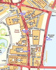
Description: Map of Whitehall, City of Westminster
Title: Whitehall OS OpenData map
Credit: Ordnance Survey OpenData
Author: OS OpenData with modifications by Prioryman
Permission: Note: Derivative works can be licensed under any Creative Commons Attribution 3.0 Licence.
Usage Terms: Ordnance Survey OpenData Licence
License: OS OpenData
License Link: https://www.ordnancesurvey.co.uk/business-and-government/licensing/using-creating-data-with-os-products/os-opendata.html
Attribution Required?: Yes
Usos del archivo
La siguiente página enlaza a este archivo:

Todo el contenido de los artículos de la Enciclopedia Kiddle (incluidas las imágenes) se puede utilizar libremente para fines personales y educativos bajo la licencia Atribución-CompartirIgual a menos que se indique lo contrario.