
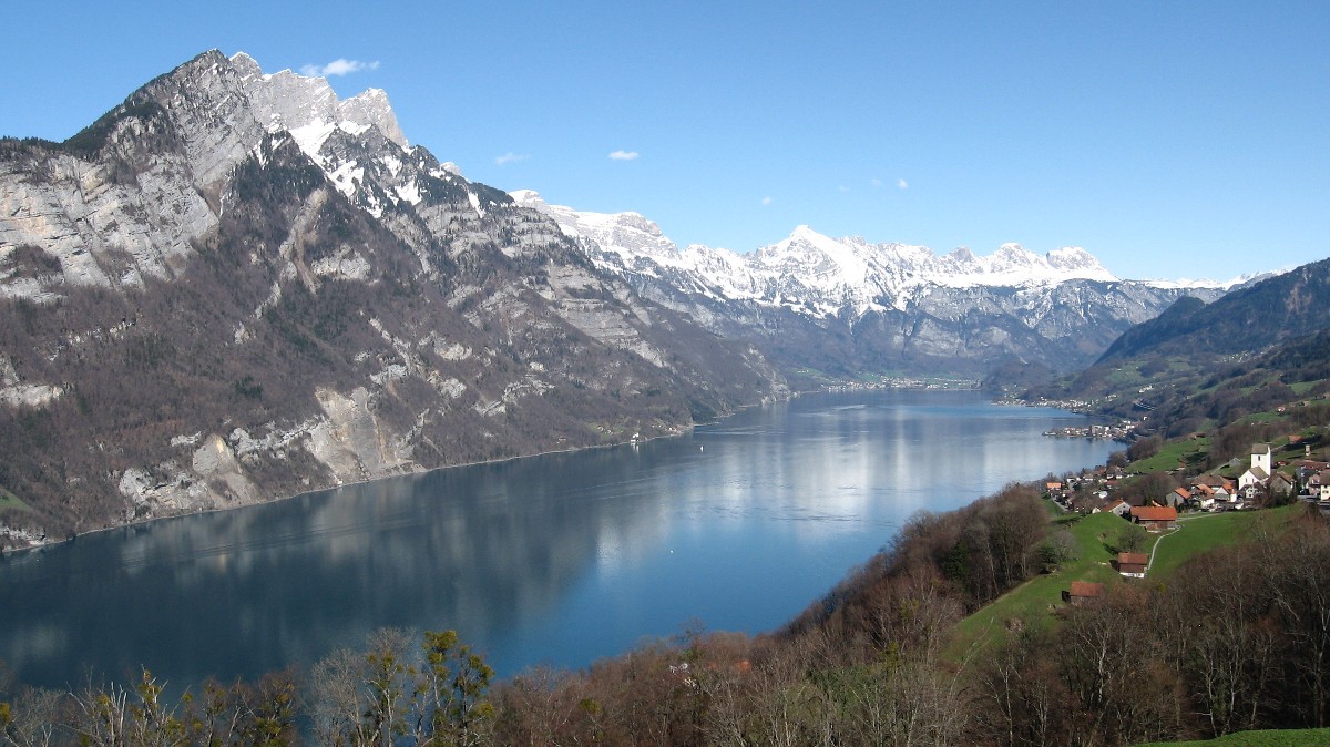
Archivo: Walensee from Kerenzerberg to East
Tamaño de esta previsualización: 800 × 449 píxeles. Otras resoluciones: 320 × 180 píxeles | 1200 × 674 píxeles.
Archivo original (1200 × 674 píxeles; tamaño de archivo: 235 KB; tipo MIME: image/jpeg)
Descripción: Walensee as seen from Kerenzerberg towards East. Kerenzerberg was the ancient road for the steep shore of the lake, there's no road to the settlement Quinten on the northern shore. Mountains are Churfirsten the row to the left and Sichelchamm the distinct triangle at the far end.
Título: Walensee from Kerenzerberg to East
Créditos: Trabajo propio
Autor(a): Caumasee
Términos de Uso: Creative Commons Attribution-Share Alike 3.0
Licencia: CC BY-SA 3.0
Enlace de Licencia: https://creativecommons.org/licenses/by-sa/3.0
¿Se exige la atribución?: Sí
Usos del archivo
La siguiente página enlaza a este archivo:

Todo el contenido de los artículos de la Enciclopedia Kiddle (incluidas las imágenes) se puede utilizar libremente para fines personales y educativos bajo la licencia Atribución-CompartirIgual a menos que se indique lo contrario.