
Archivo: VaticanCity Annex
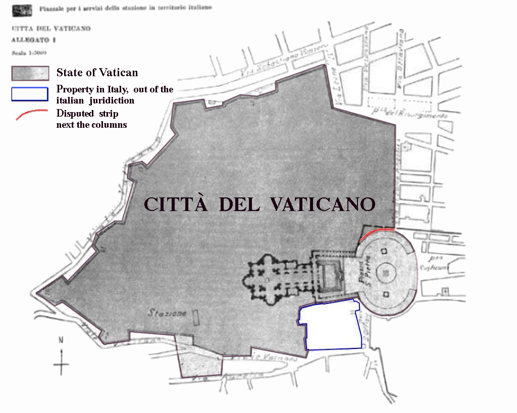
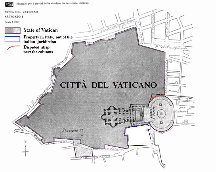
Description: Boundary map taken from the annex of the Lateran treaties. Colored areas are modifications of original image for purposes of clarification. dark grey: territory of Vatican City. light grey: territory of Vatican City. Security dispositive of Italy. Free access to public and to Italian police authorities may be revoked at any time for special ceremonial occasions. red: The small strip (3 m wide, 60 m long) alongside the northern colonnade is - according to the Lateran treaties - Italian territory and underlies Italian jurisdiction. This fact has been disputed by the mixed Italian-Vatican commission which was in place until 1932 to refine and detail the findings of the treaties. Since this commission had only a consultatory status Italy does not recognize any legal relevance of this dispute. blue zone: territory of Italy, but in possession of the Holy See. The area has extraterritorial status and Italian jurisdiction is not applied. The area contains the seat of the en:Congregation for the Doctrine of the Faith, the bigger part of the en:Paul VI Audience Hall, the Campo Santo Teutonico and the German College. other: The light grey area next to the station has evidently been added in by mistake and is Italian territory.
Title: VaticanCity Annex
Credit: Annex of the Lateran Treaty
Author: Original: de:Bild:Vatikanstadt_Annex.jpg, amended by gugganij
Usage Terms: Public domain
License: Public domain
Attribution Required?: No
Usos del archivo
El siguiente archivo es un duplicado de éste (más detalles):
La siguiente página enlaza a este archivo:
