
Archivo: Urban-Rural Population and Land Area Estimates, v2, 2010 Bangladesh (13873798283)
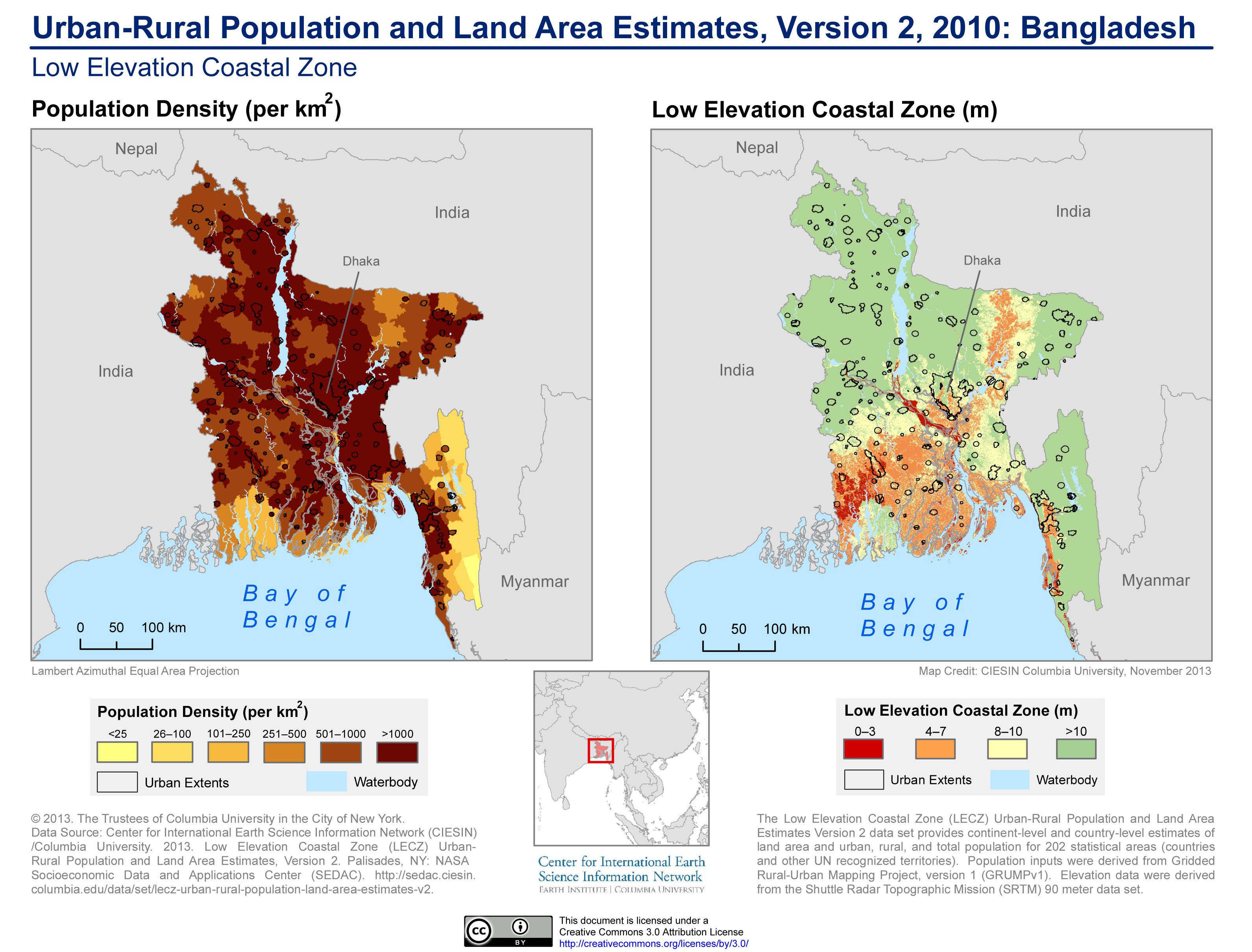
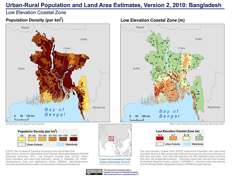
Descripción: The Low Elevation Coastal Zone (LECZ) Urban-Rural Population and Land Area Estimates Version 2 dataset provides continent-level and country-level estimates of land area and urban, rural, and total population for 202 statistical areas (countries and other UN recognized territories). Population inputs were derived from Gridded Rural-Urban Mapping Project, Version 1 (GRUMPv1). Elevation data were derived from the Shuttle Radar Topographic Mission (SRTM) 90 meter dataset.
Título: Urban-Rural Population and Land Area Estimates, v2, 2010 Bangladesh (13873798283)
Créditos: Urban-Rural Population and Land Area Estimates, v2, 2010: Bangladesh
Autor(a): SEDACMaps
Términos de Uso: Creative Commons Attribution 2.0
Licencia: CC BY 2.0
Enlace de Licencia: https://creativecommons.org/licenses/by/2.0
¿Se exige la atribución?: Sí
Usos del archivo
La siguiente página enlaza a este archivo:
.jpg&oldid=2965242)

.jpg)