
Archivo: Uncompahgre National Forest location in Colorado

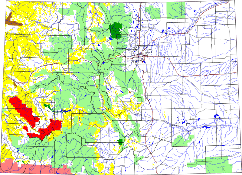
Description: A map of Colorado, with Uncompahgre National Forest highlighted in red. The light green is other Forest Service land, yellow is BLM land, dark green is National Park, brown is National Monument or National Historic Site, pink is Indian reservation. The reddish lines are Interstate Highways. David Benbennick made this map with data from nationalatlas.gov. The map uses the azimuthal equidistant projection, centered on (-105.7167, 39.1333) (degrees latitude, longitude). The area outside Colorado is transparent, so it should look nice on non-white backgrounds. Eventually, I will upload the 4 megabyte Metapost script I used to make this map. In the mean time, see map.mp.
Title: Uncompahgre National Forest location in Colorado
Credit: Own work
Author: David Benbennick
Usage Terms: Public domain
License: Public domain
Attribution Required?: No
Usos del archivo
Las siguientes páginas enlazan a este archivo:
