
Archivo: US Geo survey hurricane jose 2017
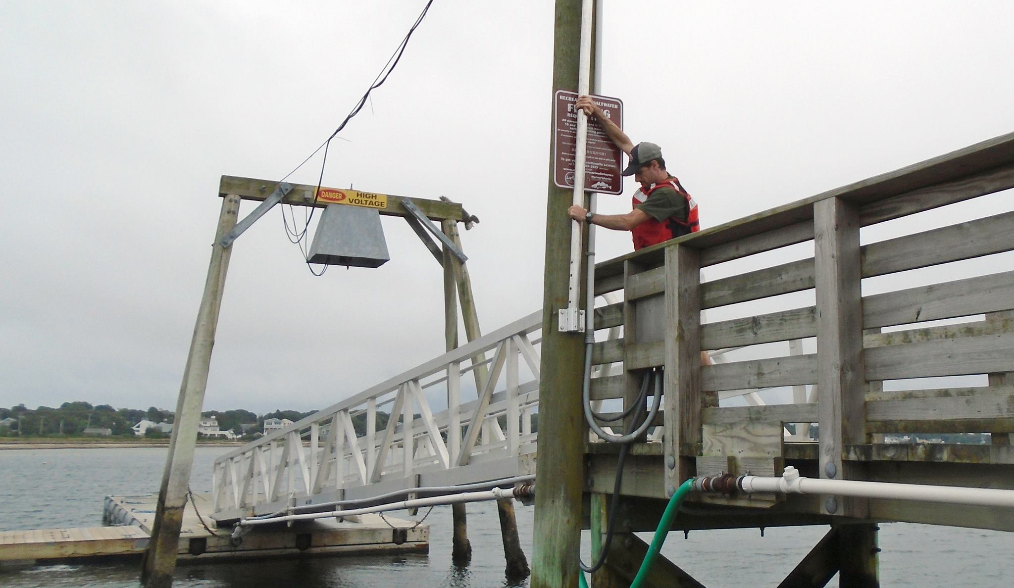
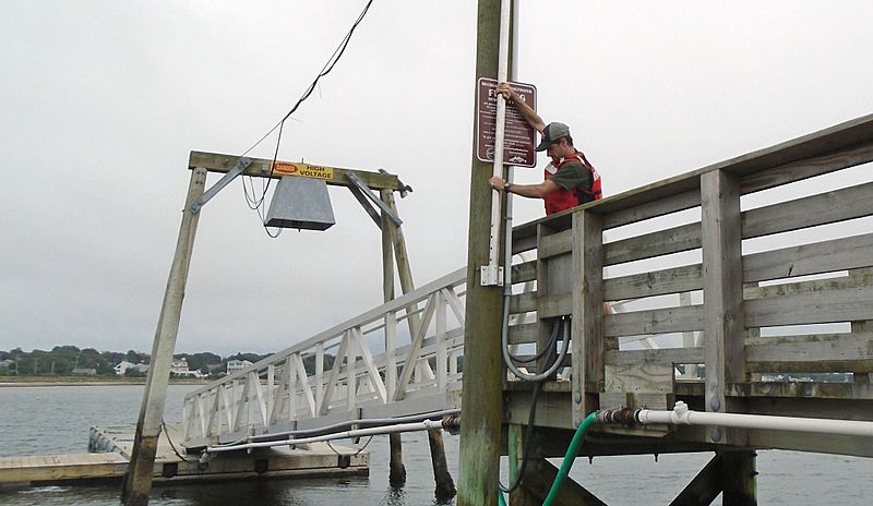
Description: In response to Hurricane Jose, U.S. Geological Survey specialists across three states installed 17 storm-tide sensors – seven in Connecticut, seven in Massachusetts and three in Rhode Island – along shorelines likely to receive some large waves and storm surge from the storm. These scientific instruments were put in place ahead of Jose to collect information about the hurricane’s effects on the coast. The retrieval of the sensors and the valuable data they hold will begin once Jose has passed. To learn where the storm-tide sensors were deployed for Jose, visit the USGS Hurricane Jose Flood Event Viewer. The U.S. Geological Survey use many forms of technology to track and document the effects of hurricanes along the Gulf and Atlantic coasts.
Title: US Geo survey hurricane jose 2017
Credit: https://www.facebook.com/USGeologicalSurvey/photos/a.169734339739224.34845.102635589782433/1544019712310673/?type=3&theater
Author: US Geological Survey
Usage Terms: Public domain
License: Public domain
Attribution Required?: No
Usos del archivo
La siguiente página enlaza a este archivo:
