
Archivo: US Congressional Districts color
Tamaño de esta previsualización PNG del archivo SVG: 800 × 482 píxeles. Otra resolución: 320 × 193 píxeles.
Archivo original (archivo SVG, nominalmente 2583 × 1557 píxeles, tamaño de archivo: 1,24 MB)
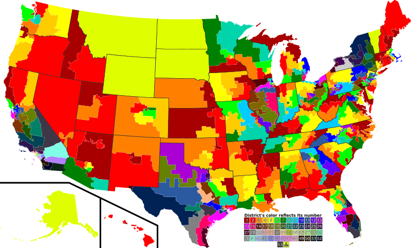
Descripción: A map of all of the U.S. congressional districts (as of the 110th Congress). To find the district's number, look at the district, compare with the color code at the bottom to get number.
Título: 110th US Congress House districts color
Créditos: Based off of: [1] for most boundaries, [2] for Georgia, and [3] for Texas.
Autor(a): Mr. Matté (if there is an issue with this image, contact me using this image's Commons talk page or my English Wikipedia talk page; I'll know about it a lot faster)
Términos de Uso: Dominio Público
Licencia: Dominio Público
¿Se exige la atribución?: No
Usos del archivo
El siguiente archivo es un duplicado de éste (más detalles):
La siguiente página enlaza a este archivo:

Todo el contenido de los artículos de la Enciclopedia Kiddle (incluidas las imágenes) se puede utilizar libremente para fines personales y educativos bajo la licencia Atribución-CompartirIgual a menos que se indique lo contrario.