
Archivo: TravisCountyDistricts
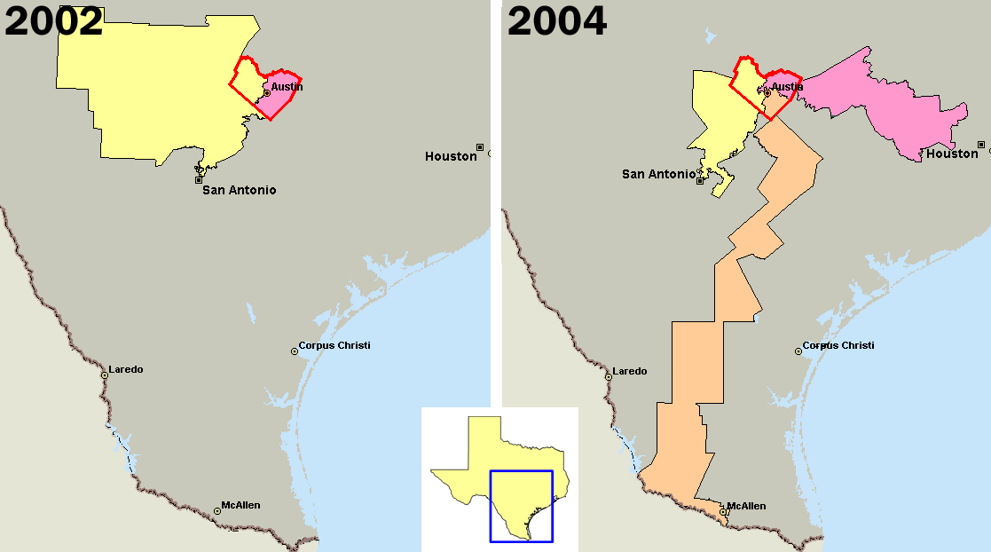
Description: U.S. congressional districts covering en:Travis County, Texas (outlined in red) in 2002, left, and 2004. In 2003, Republicans in the Texas legislature redistricted the state, diluting the voting power of the heavily Democratic county by parceling its residents out to more Republican districts. Created by me using Microsoft MapPoint 2004 and data from http://nationalatlas.gov The district in orange is the infamous "Fajita strip" district 25 (intended as a Democratic district), while the other two districts (10 and 21) are intended to elect Republicans. District 25 has now been redrawn as a result of the 2006 U.S. Supreme Court decision, and is no longer a "Fajita strip". This work has been released into the public domain by its author, PHenry. This applies worldwide. In some countries this may not be legally possible; if so: PHenry grants anyone the right to use this work for any purpose, without any conditions, unless such conditions are required by law.
Title: TravisCountyDistricts
Credit: Transferred from en.wikipedia to Commons.
Author: PHenry at English Wikipedia
Usage Terms: Public domain
License: Public domain
Attribution Required?: No
Usos del archivo
La siguiente página enlaza a este archivo:
