
Archivo: Toba Landsat satellite image
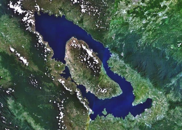
Descripción: Toba, the Earth's largest Quaternary caldera, is seen here in a NASA Landsat satellite image (with north to the top). The 35 x 100 km caldera, partially filled by Lake Toba, was formed during four major ignimbrite-forming eruptions in the Pleistocene, the latest of which occurred about 74,000 years ago. The large island of Samosir is a resurgent uplifted block. The solfatarically active Pusukbukit volcano was later constructed near the south-central caldera rim, and Tandukbenua volcano on the NW rim may be only a few hundred years old.
Título: Toba Landsat satellite image
Créditos: http://www.volcano.si.edu/world/volcano.cfm?vnum=0601-09=&volpage=photos&photo=114091
Autor(a): NASA Landsat7 image (worldwind.arc.nasa.gov)
Términos de Uso: Dominio Público
Licencia: Dominio Público
¿Se exige la atribución?: No
Usos del archivo
La siguiente página enlaza a este archivo:
