
Archivo: Theodosius I's empire
No disponible en mayor resolución.
Theodosius_I's_empire.png (563 × 406 píxeles; tamaño de archivo: 24 KB; tipo MIME: image/png)
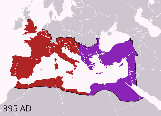
Description: Map of the boundaries of the western and eastern Roman empires after the death of Theodosius I, in 395 AD. Western Roman Empire Eastern Roman (Byzantine) Empire
Title: Theodosius I's empire
Credit: Made personally from Image:BlankMap-Europe-v3.png, using (2004). The Collins Atlas of World History. Wiltshire: HarperCollins, 46-47. 0-00-716640-0. and Image:Roman empire 395.jpg as a source.
Author: Geuiwogbil at en.wikipedia
Usage Terms: Creative Commons Attribution-Share Alike 3.0
License: CC-BY-SA-3.0
License Link: http://creativecommons.org/licenses/by-sa/3.0/
Attribution Required?: Yes
Usos del archivo
Las siguientes páginas enlazan a este archivo:

Todo el contenido de los artículos de la Enciclopedia Kiddle (incluidas las imágenes) se puede utilizar libremente para fines personales y educativos bajo la licencia Atribución-CompartirIgual a menos que se indique lo contrario.