
Archivo: The earth and its inhabitants (1894) (14743436356)
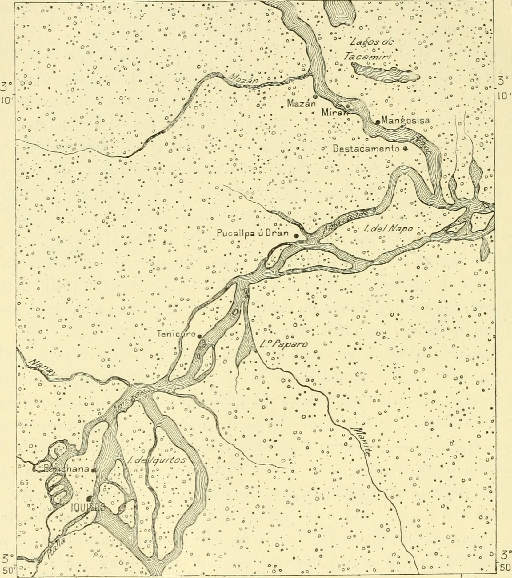
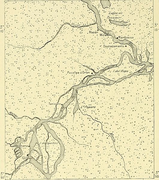
Descripción: Identifier: earthitsinhabita941recl (find matches) Title: The earth and its inhabitants .. Year: 1894 (1890s) Authors: Reclus, Elisée, 1830-1905 Ravenstein, Ernest George, 1834-1913 Keane, A. H. (Augustus Henry), 1833-1912 Subjects: Geography Publisher: New York, D. Appleton and company Contributing Library: MBLWHOI Library Digitizing Sponsor: Boston Library Consortium Member Libraries View Book Page: Book Viewer About This Book: Catalog Entry View All Images: All Images From Book Click here to view book online to see this illustration in context in a browseable online version of this book. Text Appearing Before Image: d Inca city ; but after the War ofIndependence nearly all emigrated, and most of the old palaces, more or lessdebased, are now occupied by Quichua half-breeds. But a revival must takeplace when the ancient City of the Sun will be placed in direct railway communi-cation with the Pacific Ocean by the Arequipa line. Ollantaï-tambo—Sarayacu—Omagua. Puins are also numerous in the environs. The original kingdom of the Incas,at first of small extent, was here defended by fortresses, whose remains are stillseen on the Apurimac, the Vilcanota and the Paucartambo. Ollantaï-tambo, 340 SOUTH AMERICA—THE ANDES EEGIONS. most imposing of these strongholds, which is reached by crossing the Yilcanota,between Maras and Urnbamba, may still be regarded as marking the frontier o£Peru, properly so called. Beyond it nothing is seen except a few obscure villages,hamlets, farmsteads or Indian huts. Civilisation is advancing timidly to the Fig. 132.—Iquitos and the Napo Confluence.Scale 1 : 750,000. Text Appearing After Image: 75°l0 West or Greenwich 72°W 15 Miles. re-conquest of this fertile valley, which was wasted in the eighteenth century bythe Chuncho natives, who burnt no less than 115 plantations. Sarayacu, the chief riverine port of the lower Ucayali, lies on a lateral creek,where some Franciscan missionaries have gathered round them Indians ofvarious tribes—Piros, Cachibos, Orejones—who have adopted neither Spanish norPortuguese, but Quichua as the language of general intercourse. Here thetraveller enters the lowlands at an altitude of not more than 544 feet abovethe Atlantic, and steamers easily ascend from the Amazons to Sarayacu. TOPOGRAPHY OF PEEU. 341 At the confluence of the Maraiïon and Ucayali, the two main head branchesof the Amazons, the village of Nauta is perched on a cliff which rises some34 feet above low-water level. Founded in 1S30 on the site of an old mission,this little group of straw huts is inhabited by the Cocaraas Indians and a fewhalf-breeds ; it is far from possessin Note About Images Please note that these images are extracted from scanned page images that may have been digitally enhanced for readability - coloration and appearance of these illustrations may not perfectly resemble the original work.
Título: The earth and its inhabitants (1894) (14743436356)
Créditos: https://www.flickr.com/photos/internetarchivebookimages/14743436356/ Source book page: https://archive.org/stream/earthitsinhabita941recl/earthitsinhabita941recl#page/n423/mode/1up
Autor(a): Internet Archive Book Images
Permiso: At the time of upload, the image license was automatically confirmed using the Flickr API. For more information see Flickr API detail.
Términos de Uso: No known copyright restrictions
Licencia: No restrictions
Enlace de Licencia: https://www.flickr.com/commons/usage/
¿Se exige la atribución?: No
Usos del archivo
La siguiente página enlaza a este archivo:
_(14743436356).jpg&oldid=3018163)

_(14743436356).jpg)