
Archivo: The Trundle east gate 1930 excavations annotated
Tamaño de esta previsualización: 800 × 433 píxeles. Otras resoluciones: 320 × 173 píxeles | 1200 × 650 píxeles.
Archivo original (1200 × 650 píxeles; tamaño de archivo: 417 KB; tipo MIME: image/jpeg)
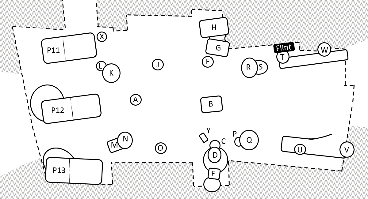
Description: The plan shows the area cleared down to chalk, and the pits and postholes excavated within that area, in the east gate of The Trundle, 1930. The grey background represents the earthworks of the Iron Age ramparts, and the dotted lines outline the cleared area. Redrawn from source: Curwen, E.C. (1931). "Excavations in The Trundle, Second Season, 1930". Sussex Archaeological Collections. 72: 100–149. doi:10.5284/1086064.
Title: The Trundle east gate 1930 excavations annotated
Credit: Own work
Author: Mike Christie
Usage Terms: Creative Commons Attribution-Share Alike 4.0
License: CC BY-SA 4.0
License Link: https://creativecommons.org/licenses/by-sa/4.0
Attribution Required?: Yes
Usos del archivo
La siguiente página enlaza a este archivo:

Todo el contenido de los artículos de la Enciclopedia Kiddle (incluidas las imágenes) se puede utilizar libremente para fines personales y educativos bajo la licencia Atribución-CompartirIgual a menos que se indique lo contrario.