
Archivo: The Diomede Islands in the BeringSea (picture from space)
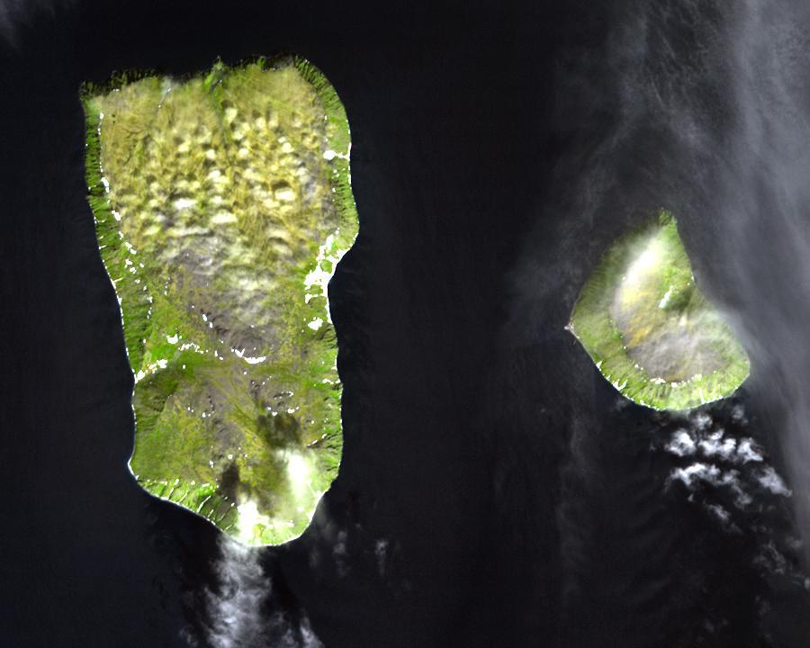
Description: Diomede Islands in the middle of the Bering Strait: Western: Russian island of Big Diomede, Imaqliq, Nunarbuk or Ratmanov Island Eastern: U.S. island of Little Diomede, in its native language Inaliq or Krusenstern Island The islands are separated by the border between Russia and the USA and by the International Date Line. The image was acquired July 8, 2000, covers an area of 13.5 x 10.8 km, and is located at 65.8 degrees north latitude, 169 degrees west longitude.
Title: The Diomede Islands in the BeringSea (picture from space)
Credit: Image: diomede.jpg Text info: Diomede Islands, Bering Strait Please give credit for these images to: NASA/GSFC/METI/Japan Space Systems and U.S./Japan ASTER Science Team. This file is in the public domain because it was created by NASA. NASA copyright policy states that "NASA material is not protected by copyright unless noted". (NASA copyright policy page or JPL Image Use Policy). This image does not contain a NASA logo.
Author: Unknown
Usage Terms: Public domain
License: Public domain
Attribution Required?: No
Usos del archivo
La siguiente página enlaza a este archivo:
.jpg&oldid=578802)

.jpg)