
Archivo: Territorial organization of the Assyrian Empire in times of Ashurbanipal-es

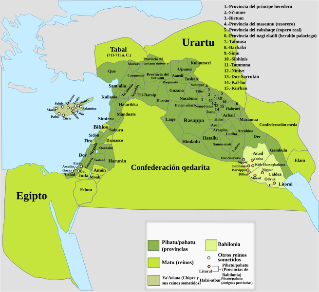
Descripción: This map show the territorial organization of Assyrian Empire un times of Ashurbanipal, in dark green is show the pahitu/pahutu (provinces) of the empire, in yellow the matu (subjects kingdoms of the empire) and in cream color the kingdom of Babylon, the yellow points show other subjects kingdoms and the black points the pahitu/pahutu (provinces) of the Babylon kingdom, and with brown letters pahitu/pahutu (provinces) that existed previously.
Título: Territorial organization of the Assyrian Empire in times of Ashurbanipal-es
Créditos: Este archivo deriva de: Territorial organization of the Assyrian Empire in times of Ashurbanipal.svg
Autor(a): Rowanwindwhistler
Términos de Uso: Creative Commons Attribution-Share Alike 4.0
Licencia: CC BY-SA 4.0
Enlace de Licencia: https://creativecommons.org/licenses/by-sa/4.0
¿Se exige la atribución?: Sí
Usos del archivo
Las siguientes páginas enlazan a este archivo:
