
Archivo: Tashkent History 1860

Tamaño de esta previsualización: 792 × 600 píxeles. Otras resoluciones: 317 × 240 píxeles | 844 × 639 píxeles.
Archivo original (844 × 639 píxeles; tamaño de archivo: 292 KB; tipo MIME: image/jpeg)
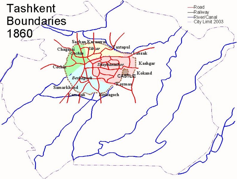
Description: Map Of Tashkent in 1860 showing the boundaries of the city, main roads, railways and waterways. (1 of 7)
Title: Tashkent History 1860
Credit: Self generated by author based on the Geographical Atlas of Tashkent (Ташкент Географический Атлас, Москва 1984)
Author: G Cosnahan
Usage Terms: GNU Free Documentation License
License: GFDL
License Link: http://www.gnu.org/copyleft/fdl.html
Attribution Required?: Yes
Usos del archivo
La siguiente página enlaza a este archivo:

Todo el contenido de los artículos de la Enciclopedia Kiddle (incluidas las imágenes) se puede utilizar libremente para fines personales y educativos bajo la licencia Atribución-CompartirIgual a menos que se indique lo contrario.