
Archivo: Tambora EFS highres STS049 STS049-97-54
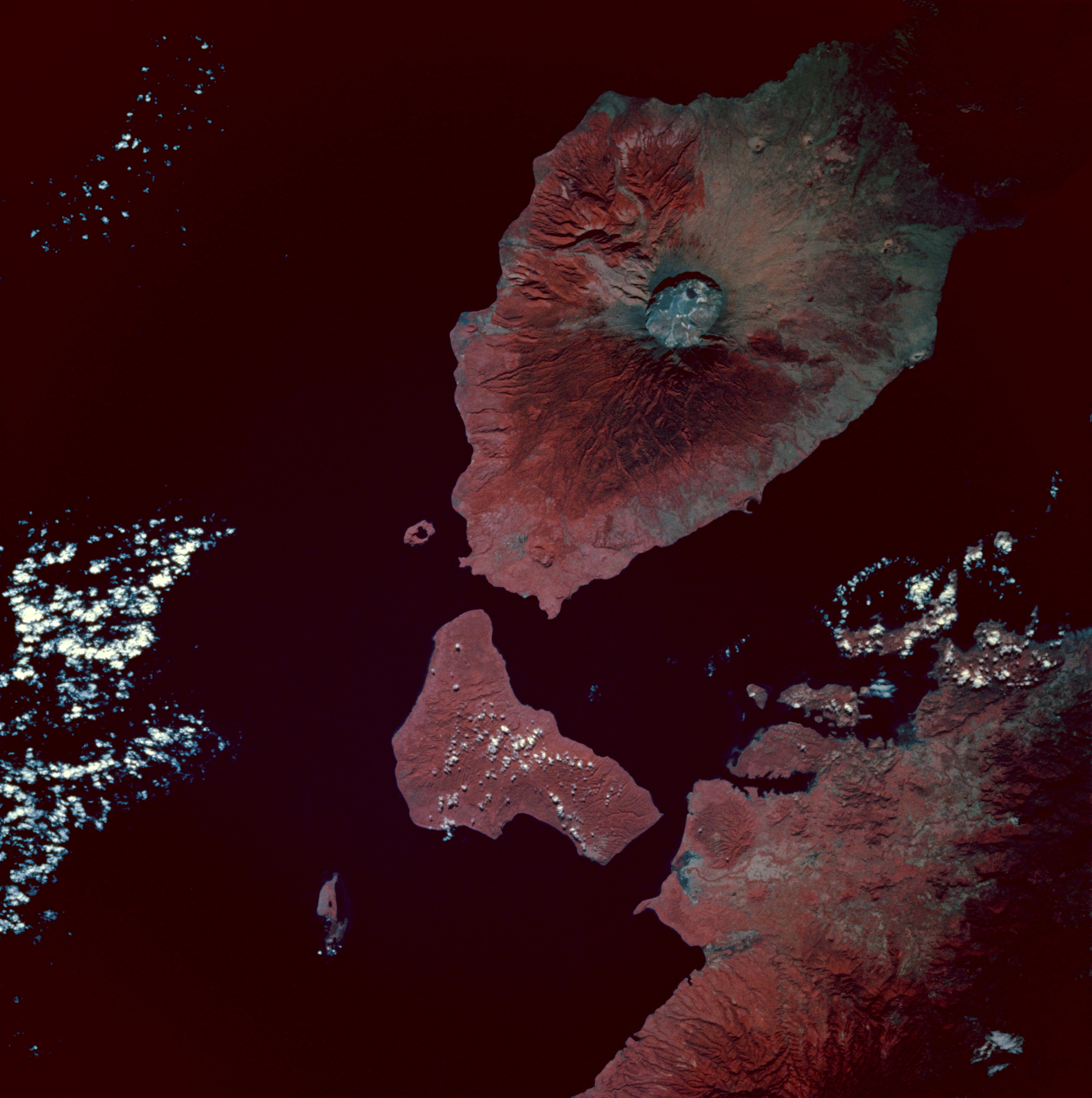
Description: Infrared image of Mount Tambora, Sumbawa Island, Indonesia. Taken from the space shuttle Endeavour at 0:54 GMT on 13 May 1992. Description from [1]: The most striking geologic feature in this photograph is the large circular Tambora Volcano caldera, the diameter of which is slightly more than 3 miles (5 kilometers). Prior to the disastrous eruption of 1815 when the volcano blew away most of its top, Tambora’s summit was approximately 13 000 feet (4000 meters) above sea level. The present elevation of the caldera rim is more than 9000 feet (2700 meters) above sea level. Many geologists and volcanologists rank the 1815 eruption among the 10 most explosive eruptions of the modern era. Tambora, a classic stratovolcano with steep slopes and a symmetrical shape, is located on the north-central coast of Sumbawa Island, Indonesia, which is bordered on the north by the Flores Sea and on the southwest by Teluk Saleh Bay. Color infrared film, which displays green vegetation in varying shades of red, accentuates the distribution patterns of dense tropical vegetation surrounding the volcano and other land areas in the photograph.
Title: Tambora EFS highres STS049 STS049-97-54
Credit: [2]
Author: Image Science and Analysis Laboratory, NASA-Johnson Space Center. "The Gateway to Astronaut Photography of Earth".
Usage Terms: Public domain
License: Public domain
Attribution Required?: No
Usos del archivo
La siguiente página enlaza a este archivo:
