
Archivo: Tahalra
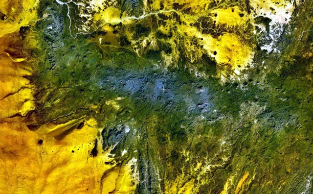
Descripción: The dark-green and bluish-gray areas extending across this NASA Landsat image depict the elongated, E-W-trending Tahalra volcanic field, which covers an area of about 1800 sq km in the Hoggar Province of southern Algeria. About 100 small strombolian basaltic cones formed during the Pliocene and Pleistocene, and the most recent activity during the late-Pleistocene and Holocene produced about 20 maars and cones along the northern margin of the volcanic field.
Título: Tahalra
Créditos: http://www.volcano.si.edu/world/volcano.cfm?vnum=0205-004&volpage=photos&photo=119026
Autor(a): NASA Landsat7 image (worldwind.arc.nasa.gov)
Términos de Uso: Dominio Público
Licencia: Dominio Público
¿Se exige la atribución?: No
Usos del archivo
La siguiente página enlaza a este archivo:
