
Archivo: Syria and Iraq 2014-onward War map
Tamaño de esta previsualización: 785 × 600 píxeles. Otras resoluciones: 314 × 240 píxeles | 4501 × 3439 píxeles.
Archivo original (4501 × 3439 píxeles; tamaño de archivo: 2,42 MB; tipo MIME: image/png)
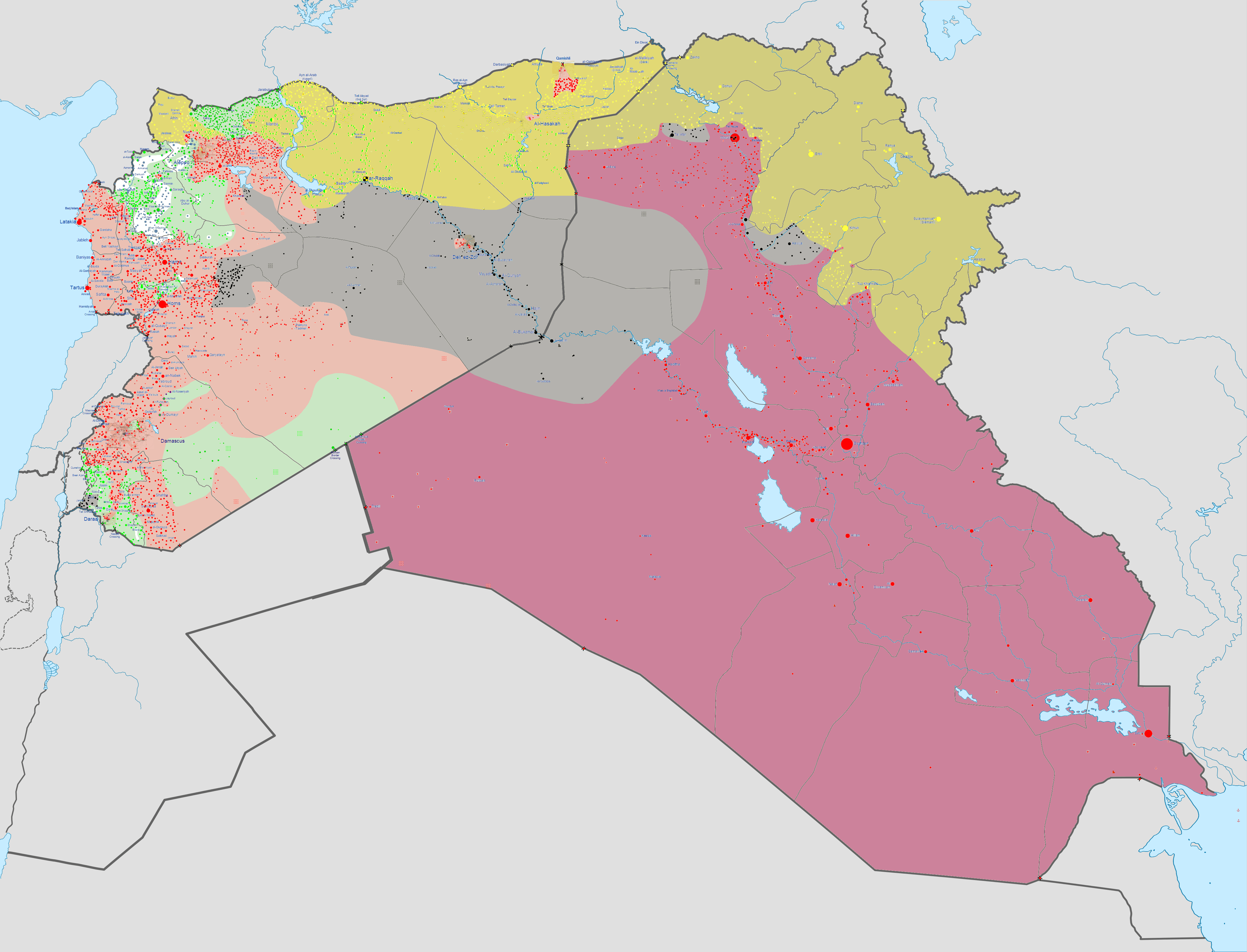
Description: English: Map of the Syrian Civil War and the Iraq War (2014–present). Controlled by the Syrian opposition Controlled by the Syrian government Controlled by the Iraqi government Controlled by the Islamic State of Iraq and the Levant (ISIL) Controlled by al-Nusra Controlled by Syrian Kurdistan Controlled by Iraqi Kurdistan Disputed territory
Title: Syria and Iraq 2014-onward War map
Credit: Own work w:en:Template:Syrian and Iraqi insurgency detailed map
Author: Haghal Jagul
Usage Terms: Creative Commons Zero, Public Domain Dedication
License: CC0
License Link: http://creativecommons.org/publicdomain/zero/1.0/deed.en
Attribution Required?: No
Usos del archivo
La siguiente página enlaza a este archivo:

Todo el contenido de los artículos de la Enciclopedia Kiddle (incluidas las imágenes) se puede utilizar libremente para fines personales y educativos bajo la licencia Atribución-CompartirIgual a menos que se indique lo contrario.