
Archivo: Swabia in the late 18th century
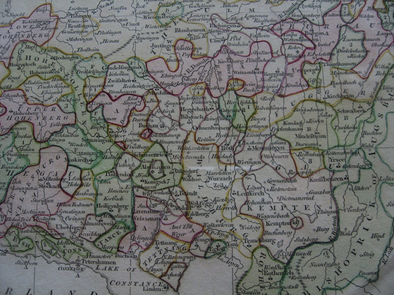
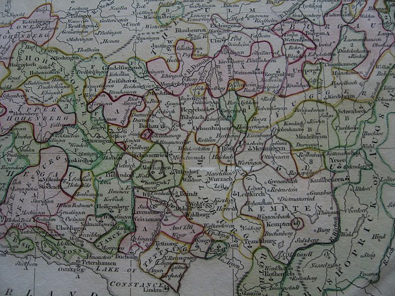
Descripción: Swabia, particularly the southeast, was a tangle of small Imperial abbeys, Free Imperial cities and secular principalities, symbolised on this map by a black rectangle topped with a crozier, a cross and a vertical bar respectively. A combination of crozier and cross denotes a territory belonging to both an Imperial abbey and an Imperial city. (enclaves in pink ("A") belong to Anterior Austria (Vorderösterreich); with "F" to Fürstenberg; "B" to Bavaria; "W" to Wurtemberg; "2" to Augsburg; "3" to Buchau; "4" to Salmansweil; "5" to Petershausen; "6" to Waldberg; "7" to Rothenfels; "8" = to Fugger; "9" to Pappeheim; iron cross, to Teutonic Order). Cropped from a map of Swabia published by R. Wilkinson in 1802.
Título: Swabia in the late 18th century
Créditos: Trabajo propio
Autor(a): Lubiesque
Términos de Uso: Creative Commons Attribution-Share Alike 3.0
Licencia: CC BY-SA 3.0
Enlace de Licencia: https://creativecommons.org/licenses/by-sa/3.0
¿Se exige la atribución?: Sí
Usos del archivo
La siguiente página enlaza a este archivo:
