
Archivo: StAugustine1702Siege
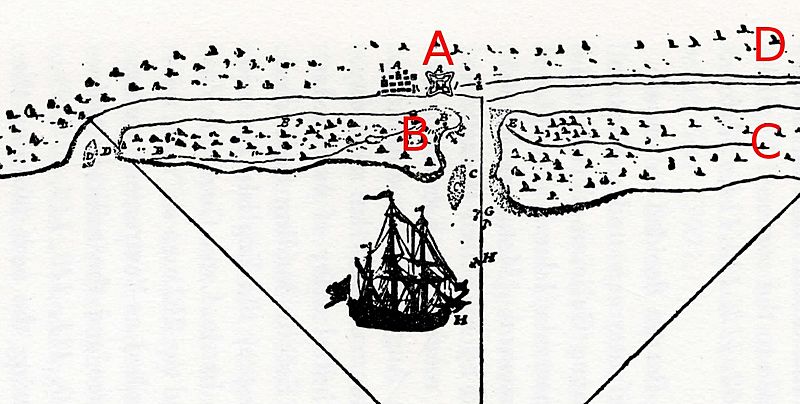
Descripción: Detail from a period French map depicting the 1702 Siege of St. Augustine. Image has been cropped and annotated as follows: A: Location of town of St. Augustine and the Castillo de San Marcos B: Island across the Matanzas River channel. This is where the English landed their boats; the Spanish reinforcements were landed on the other end of the island. C: The retreat route of James Moore D: The arrival and retreat route of Robert Daniel
Título: StAugustine1702Siege
Créditos: Scanned from Charles Arnade, The Siege of St. Augustine, 1959. Original is from the Library of Congress, #WL 255.
Autor(a): unknown French author
Términos de Uso: Dominio Público
Licencia: Dominio Público
¿Se exige la atribución?: No
Usos del archivo
La siguiente página enlaza a este archivo:
