
Archivo: Spain - Territorial division of 1822
No disponible en mayor resolución.
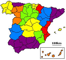
Spain_-_Territorial_division_of_1822.PNG (256 × 233 píxeles; tamaño de archivo: 4 KB; tipo MIME: image/png)
Descripción: Territorial division of Spain proposed in 1822 during the Trienio Liberal. The colored regions here properly date from 1833, not 1822. They are used here just to enable easy comparison of the maps.
Título: Spain - Territorial division of 1822
Créditos: Based on File:Map Spain 1822 (2).PNG with colors changed to match those of File:Map Spain 1833.png. Modifications by Joe Mabel
Autor(a): Joe Mabel, based on work by FCPB and User:Jmadrid
Términos de Uso: Creative Commons Attribution-Share Alike 3.0
Licencia: CC BY-SA 3.0
Enlace de Licencia: https://creativecommons.org/licenses/by-sa/3.0
¿Se exige la atribución?: Sí
Usos del archivo
Las siguientes páginas enlazan a este archivo:

Todo el contenido de los artículos de la Enciclopedia Kiddle (incluidas las imágenes) se puede utilizar libremente para fines personales y educativos bajo la licencia Atribución-CompartirIgual a menos que se indique lo contrario.