
Archivo: Southeastern part of the Sasanian Empire
Tamaño de esta previsualización: 800 × 478 píxeles. Otras resoluciones: 320 × 191 píxeles | 1165 × 696 píxeles.
Archivo original (1165 × 696 píxeles; tamaño de archivo: 1,05 MB; tipo MIME: image/jpeg)
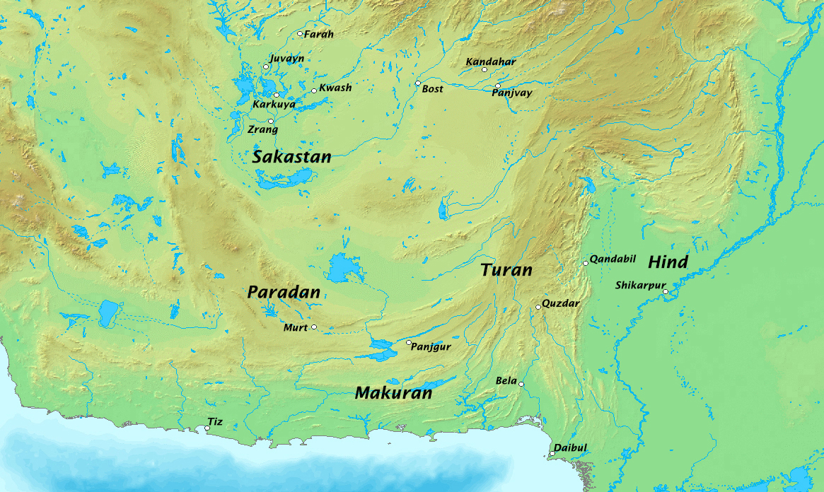
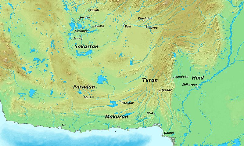
Description: Map of the southeastern part of the early Sasanian Empire (not fully done yet). Mainly based on the Sasanian map in the Cambridge History of Iran, volume 3. Map taken from DEMIS Mapserver, which is public domain, the rest is self-made.
Title: Southeastern part of the Sasanian Empire
Credit: Own work
Author: HistoryofIran
Usage Terms: Creative Commons Attribution-Share Alike 3.0
License: CC BY-SA 3.0
License Link: https://creativecommons.org/licenses/by-sa/3.0
Attribution Required?: Yes
Usos del archivo
La siguiente página enlaza a este archivo:

Todo el contenido de los artículos de la Enciclopedia Kiddle (incluidas las imágenes) se puede utilizar libremente para fines personales y educativos bajo la licencia Atribución-CompartirIgual a menos que se indique lo contrario.