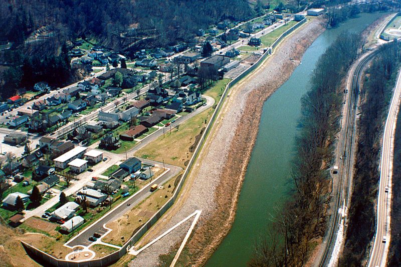
Archivo: South Williamson Kentucky aerial view

Description: Aerial view of South Williamson, Kentucky, USA. The town is protected by a floodwall built along the Tug Fork River by the U.S. Army Corps of Engineers. The river here is the border between Kentucky and West Virginia. The view in this photograph is from the West Virginia side looking south-southwest over the river to South Williamson, Kentucky.
Title: South Williamson Kentucky aerial view
Credit: U.S. Army Corps of Engineers Digital Visual Library Image page Image description page Digital Visual Library home page
Author: U.S. Army Corps of Engineers, photographer not specified or unknown
Permission: This image or file is a work of a U.S. Army Corps of Engineers soldier or employee, taken or made as part of that person's official duties. As a work of the U.S. federal government, the image is in the public domain. English | italiano | Nederlands | русский | Türkçe | українська | +/−
Usage Terms: Public domain
License: Public domain
Attribution Required?: No
Usos del archivo
La siguiente página enlaza a este archivo:

