
Archivo: South Dakota general map 2
Tamaño de esta previsualización: 800 × 543 píxeles. Otras resoluciones: 320 × 217 píxeles | 2254 × 1531 píxeles.
Archivo original (2254 × 1531 píxeles; tamaño de archivo: 3,71 MB; tipo MIME: image/png)
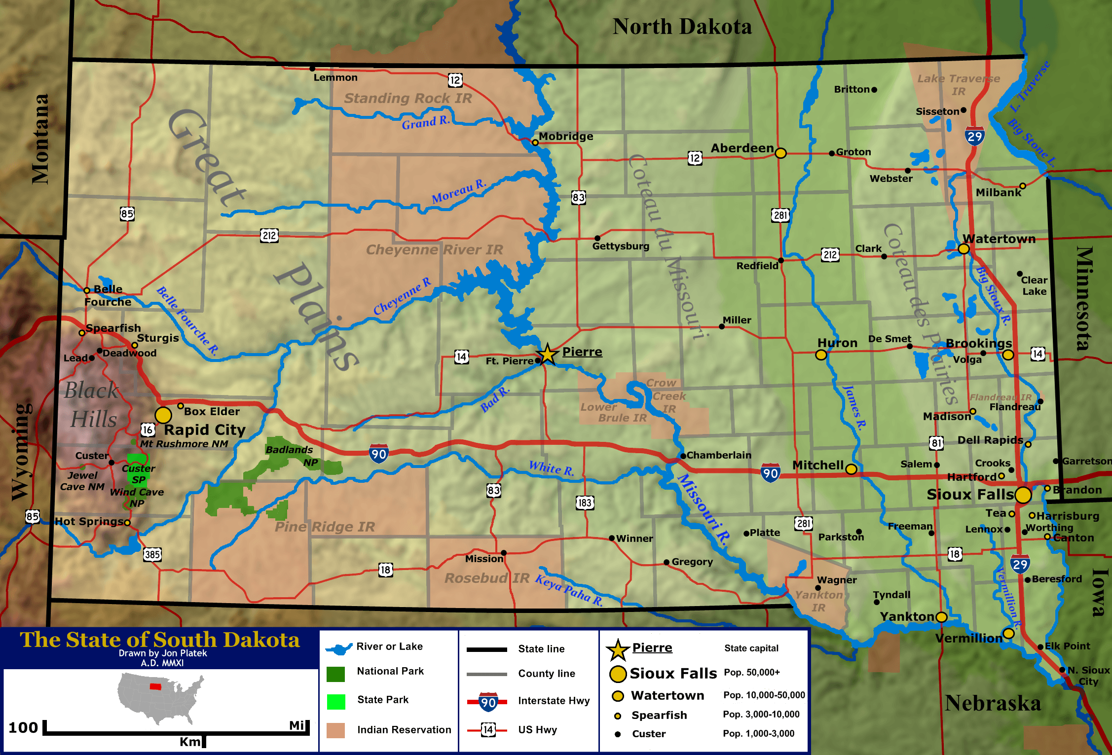
Description: General map of the US state of South Dakota. Shown are the state's topography, major cities and roads, boundaries, and bodies of water.
Title: South Dakota general map 2
Credit: Base topography map is from the public domain National Atlas, as were several layers used as reference points. Highway shields were by User:SPUI and released to the public domain. US locator map was by User:Theshibboleth. All other work was done by the uploader.
Author: Jon Platek.
Usage Terms: Creative Commons Attribution-Share Alike 3.0
License: CC BY-SA 3.0
License Link: http://creativecommons.org/licenses/by-sa/3.0
Attribution Required?: Yes
Usos del archivo
La siguiente página enlaza a este archivo:

Todo el contenido de los artículos de la Enciclopedia Kiddle (incluidas las imágenes) se puede utilizar libremente para fines personales y educativos bajo la licencia Atribución-CompartirIgual a menos que se indique lo contrario.