
Archivo: South African Election 1948
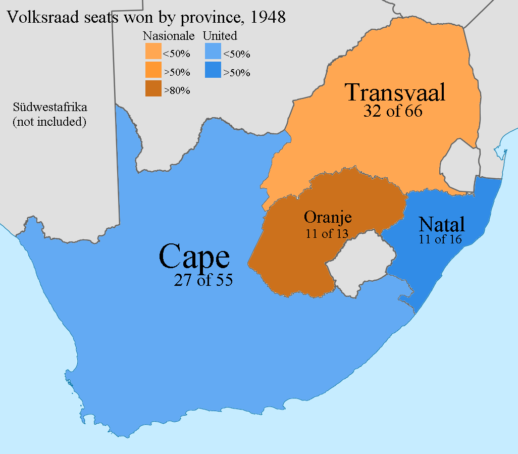
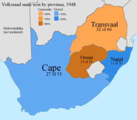
Descripción: This map shows the party elected in each province within the 1948 election of Dominion-era South Africa. Blue indicates a victory of Jan Smut's incumbent United Party, favored by anglos and moderates. Orange indicates a victory of D.F. Malan's challenging National Party, favored by Afrikaaners and the farther right. This election was especially historic as the National Party's close victory led to the implementation of the Apartheid system. This map is based off of one by User:Htonl, at https://commons.wikimedia.org/wiki/File:Map_of_South_Africa_with_provincial_borders_1910-1976.svg, under a compatible licence.
Título: South African Election 1948
Créditos: Trabajo propio
Autor(a): Icantfindanunusedusernamewhyme
Términos de Uso: Creative Commons Attribution-Share Alike 3.0
Licencia: CC BY-SA 3.0
Enlace de Licencia: https://creativecommons.org/licenses/by-sa/3.0
¿Se exige la atribución?: Sí
Usos del archivo
La siguiente página enlaza a este archivo:
