
Archivo: Sibirien topo2
Tamaño de esta previsualización: 800 × 490 píxeles. Otras resoluciones: 320 × 196 píxeles | 1590 × 973 píxeles.
Archivo original (1590 × 973 píxeles; tamaño de archivo: 684 KB; tipo MIME: image/png)
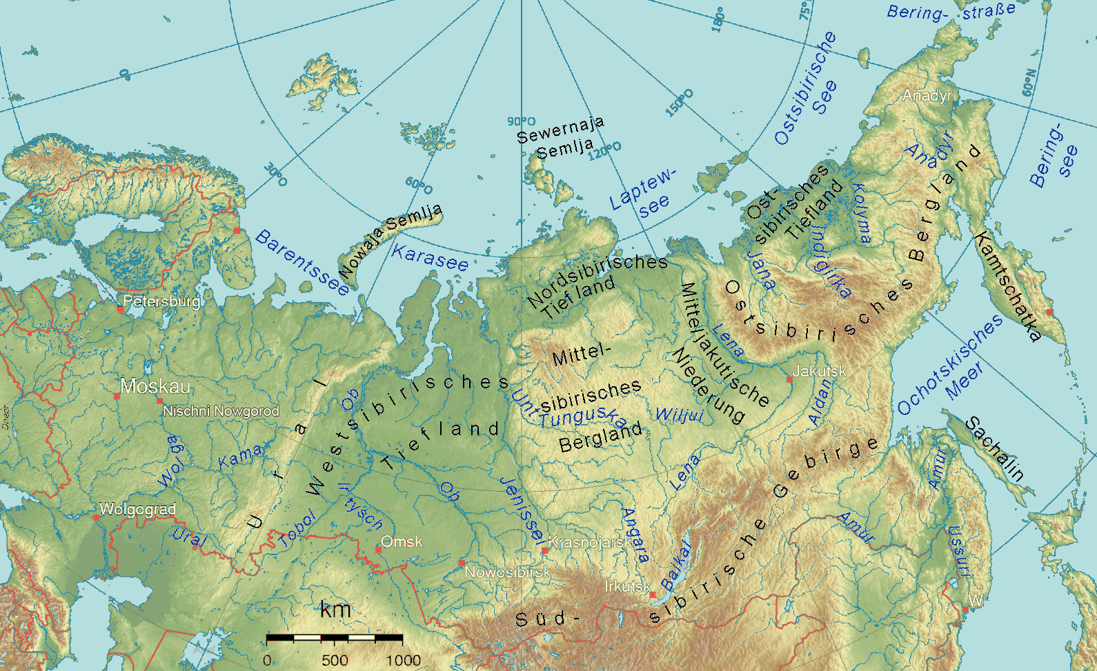
Descripción: Physical map of almost all the Russian Federation emphasizing Siberia
Título: Sibirien topo2
Créditos: Image:Russland topo.png The map has been created with the Generic Mapping Tools: http://gmt.soest.hawaii.edu/ using one or more of these public domain datasets for the relief: GLOBE (topography): http://www.ngdc.noaa.gov/mgg/topo/gltiles.html ETOPO2 (topography/bathymetry): http://dss.ucar.edu/datasets/ds759.3/ SRTM 3/30 (topography): http://srtm.usgs.gov/
Autor(a): Ulamm 21:06, 18 April 2008 (UTC)
Términos de Uso: Creative Commons Attribution-Share Alike 3.0
Licencia: CC-BY-SA-3.0
Enlace de Licencia: http://creativecommons.org/licenses/by-sa/3.0/
¿Se exige la atribución?: Sí
Usos del archivo
La siguiente página enlaza a este archivo:

Todo el contenido de los artículos de la Enciclopedia Kiddle (incluidas las imágenes) se puede utilizar libremente para fines personales y educativos bajo la licencia Atribución-CompartirIgual a menos que se indique lo contrario.