
Archivo: Shires of Scotland by population (2011)
Tamaño de esta previsualización: 460 × 600 píxeles. Otras resoluciones: 184 × 240 píxeles | 940 × 1226 píxeles.
Archivo original (940 × 1226 píxeles; tamaño de archivo: 105 KB; tipo MIME: image/png)
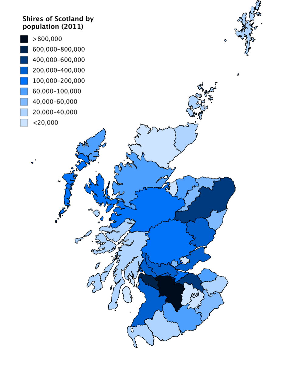
Description: A choropleth map showing population of the historic Shires of Scotland in 2011, based on data from Scotland's Census. Values were calculated by adding the population of all the civil parishes in each shire. Some parishes do not have data in the Census (1 in Fife, 2 in Forfarshire, 1 in Lanarkshire, 2 in Peeblesshire and 2 in Perthshire), and these parishes are not counted in the population of the shires.
Title: Shires of Scotland by population (2011)
Credit: Own work
Author: JackintheBox
Usage Terms: Creative Commons Attribution-Share Alike 4.0
License: CC BY-SA 4.0
License Link: https://creativecommons.org/licenses/by-sa/4.0
Attribution Required?: Yes
Usos del archivo
La siguiente página enlaza a este archivo:
.png&oldid=2661149)

Todo el contenido de los artículos de la Enciclopedia Kiddle (incluidas las imágenes) se puede utilizar libremente para fines personales y educativos bajo la licencia Atribución-CompartirIgual a menos que se indique lo contrario.
.png)