
Archivo: Second world war europe 1941-1942 map en
Tamaño de esta previsualización: 654 × 600 píxeles. Otras resoluciones: 262 × 240 píxeles | 1090 × 1000 píxeles.
Archivo original (1090 × 1000 píxeles; tamaño de archivo: 214 KB; tipo MIME: image/png)
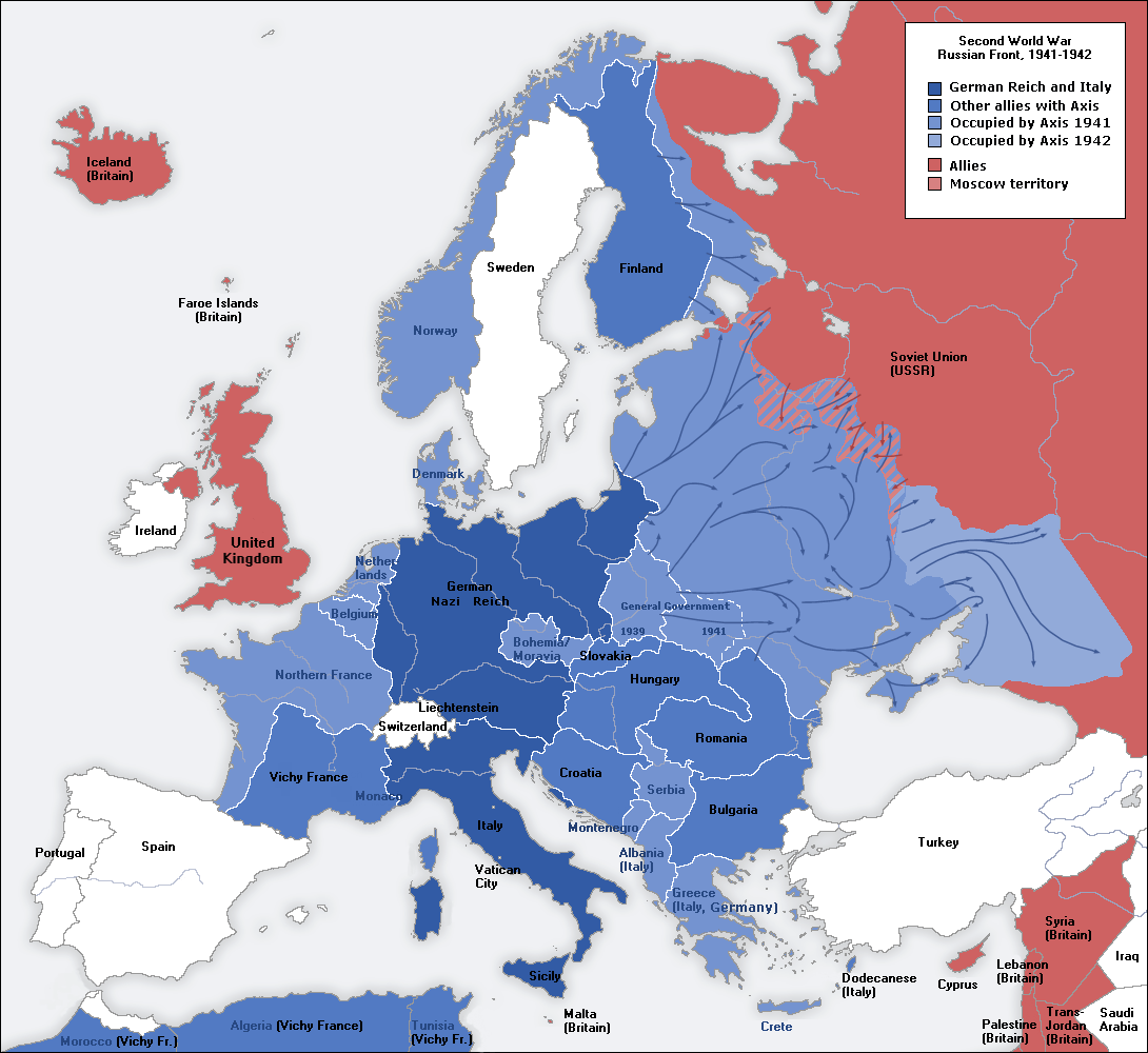
Description: A map of German front of the Second World War circa 1941-1942.
Title: Second world war europe 1941-1942 map en
Credit: This file was derived from: Second world war europe 1941-1942 map de.png
Author: Original Author: User:San Jose Derivative Author: User:ArmadniGeneral
Permission: This image is a translation of the original, created and released under the terms of the GNU Free Documentation License.
Usage Terms: Creative Commons Attribution-Share Alike 3.0
License: CC-BY-SA-3.0
License Link: http://creativecommons.org/licenses/by-sa/3.0/
Attribution Required?: Yes
Usos del archivo
La siguiente página enlaza a este archivo:

Todo el contenido de los artículos de la Enciclopedia Kiddle (incluidas las imágenes) se puede utilizar libremente para fines personales y educativos bajo la licencia Atribución-CompartirIgual a menos que se indique lo contrario.