
Archivo: SaylorvilleMines
No disponible en mayor resolución.
SaylorvilleMines.png (586 × 530 píxeles; tamaño de archivo: 65 KB; tipo MIME: image/png)
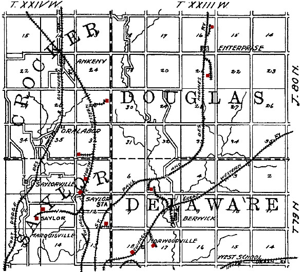
Description: Original caption: "Figure 35. Map showing location of principal Polk County mines outside of the Des Moines district." en:Saylorville, Iowa is in the lower left quadrant. Mines have been tinted red by the uploader. The railroads shown on the map are: en:Fort Dodge, Des Moines and Southern Railroad, en:Chicago and North Western Railroad, en:St. Paul and Des Moines Railroad, en:Chicago Great Western Railroad and an unidentified en:Interurban.
Title: SaylorvilleMines
Credit: The Coal Deposits of Iowa, Chapter I of Iowa Geological Survey Annual Report, 1908
Author: Henry Hinds
Usage Terms: Public domain
License: Public domain
Attribution Required?: No
Usos del archivo
La siguiente página enlaza a este archivo:

Todo el contenido de los artículos de la Enciclopedia Kiddle (incluidas las imágenes) se puede utilizar libremente para fines personales y educativos bajo la licencia Atribución-CompartirIgual a menos que se indique lo contrario.