
Archivo: Sawtooth National Forest Map with roads
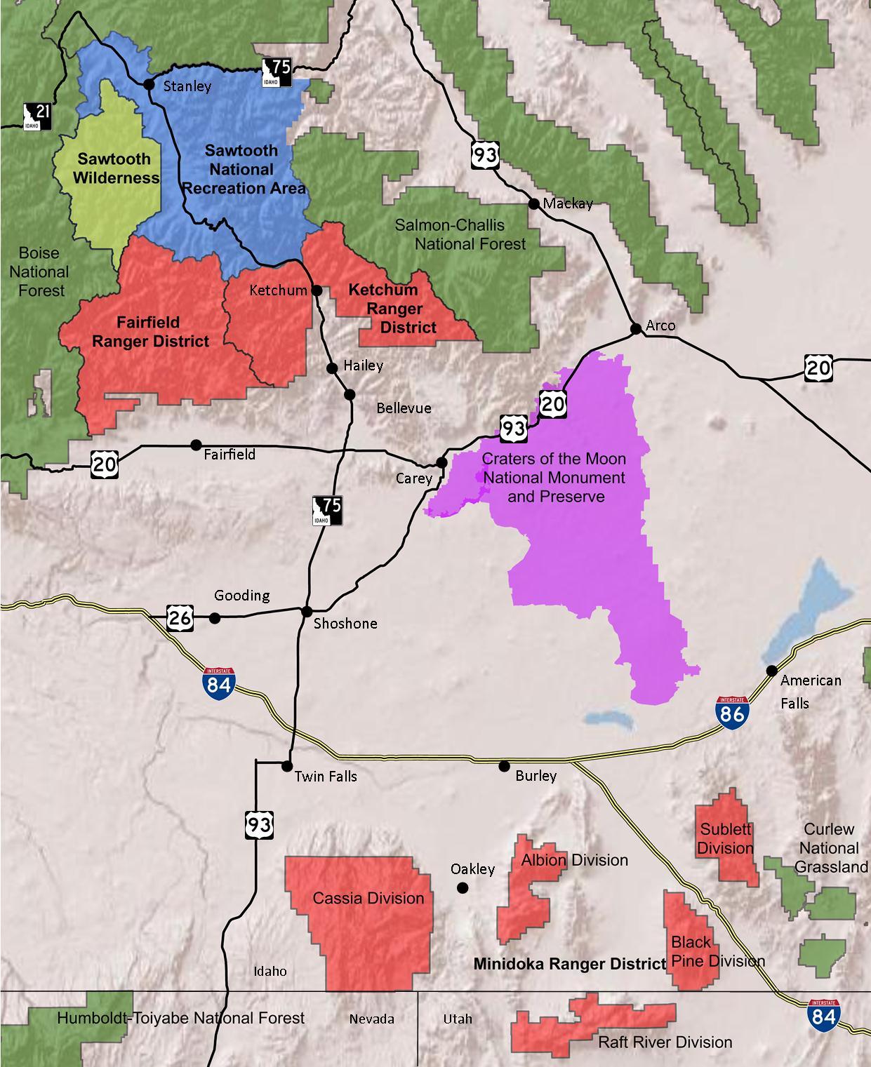
Descripción: A map of Sawtooth National Forest in Idaho and Utah. The Fairfield, Ketchum, and Minidoka Ranger Districts are in red, the Sawtooth Wilderness in yellow, and the Sawtooth National Recreation Area in blue. Surrounding National Forests, including Boise, Salmon-Challis, and Humboldt-Toiyabe, along with Curlew National Grassland are in green. Craters of the Moon National Monument and Preserve is in purple. Several roads and towns are displayed. This map was made using ARCGIS 10, and all data are in the public domain. Forest Service boundary data are from the US Forest Service FSGeodata Clearinghouse. Roads are from the National Highway Planning Network and Craters of the Moon is from the USGS National Gap Analysis Program.
Título: Sawtooth National Forest Map with roads
Créditos: Trabajo propio
Autor(a): Fredlyfish4
Términos de Uso: Creative Commons Attribution-Share Alike 3.0
Licencia: CC BY-SA 3.0
Enlace de Licencia: https://creativecommons.org/licenses/by-sa/3.0
¿Se exige la atribución?: Sí
Usos del archivo
La siguiente página enlaza a este archivo:
