
Archivo: SaltGlaciers ZagrosMtns 20010810
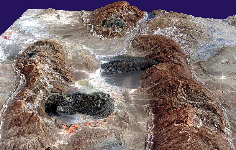
Descripción: Satellite imagery of salt domes and salt glaciers, visible as darkish irregular patches, Zagros Mountains, southern Iran, near Karmowstaj. Gravity has caused the salt to flow like glaciers into adjacent valleys. The resulting tongue-shaped bodies are more than 5 kilometers long, with repeating bow-shaped ridges separated by crevasse-like gullies and with steep sides and fronts. The darker tones are due to clays brought up with the salt, as well as the probable accumulation of airborne dust. This Aster perspective view was created by draping a band 3-2-1 (RGB) image over an ASTER-derived Digital Elevation Model (2x vertical exaggeration).
Título: SaltGlaciers ZagrosMtns 20010810
Créditos: http://earthobservatory.nasa.gov/IOTD/view.php?id=4168
Autor(a): NASA/GSFC/MITI/ERSDAC/JAROS, and U.S./Japan ASTER Science Team
Permiso: US government, public domain
Términos de Uso: Dominio Público
Licencia: Dominio Público
¿Se exige la atribución?: No
Usos del archivo
La siguiente página enlaza a este archivo:
