
Archivo: Saint Helena Island

Tamaño de esta previsualización: 800 × 600 píxeles. Otras resoluciones: 320 × 240 píxeles | 1440 × 1080 píxeles.
Archivo original (1440 × 1080 píxeles; tamaño de archivo: 634 KB; tipo MIME: image/jpeg)
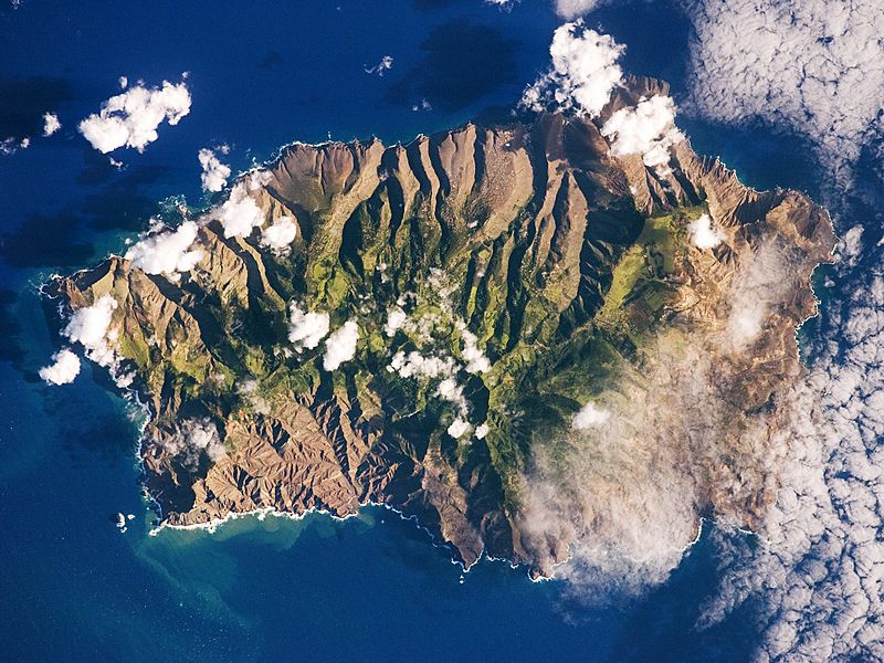
Description: This astronaut photograph shows the island’s sharp peaks and deep ravines; the rugged topography results from erosion of the volcanic rocks that make up the island. The change in elevation from the coast to the interior creates a climate gradient. The higher, wetter centre is covered with green vegetation, whereas the lower coastal areas are drier and hotter, with little vegetation cover.
Title: Saint Helena Island
Credit: NASA Earth Observatory
Author: This image was taken by the NASA Expedition 19 crew.
Usage Terms: Public domain
License: Public domain
Attribution Required?: No
Usos del archivo
Las siguientes páginas enlazan a este archivo:

Todo el contenido de los artículos de la Enciclopedia Kiddle (incluidas las imágenes) se puede utilizar libremente para fines personales y educativos bajo la licencia Atribución-CompartirIgual a menos que se indique lo contrario.