
Archivo: Rzeczpospolita 1789-1920
Tamaño de esta previsualización: 782 × 600 píxeles. Otras resoluciones: 313 × 240 píxeles | 2000 × 1534 píxeles.
Archivo original (2000 × 1534 píxeles; tamaño de archivo: 230 KB; tipo MIME: image/png)
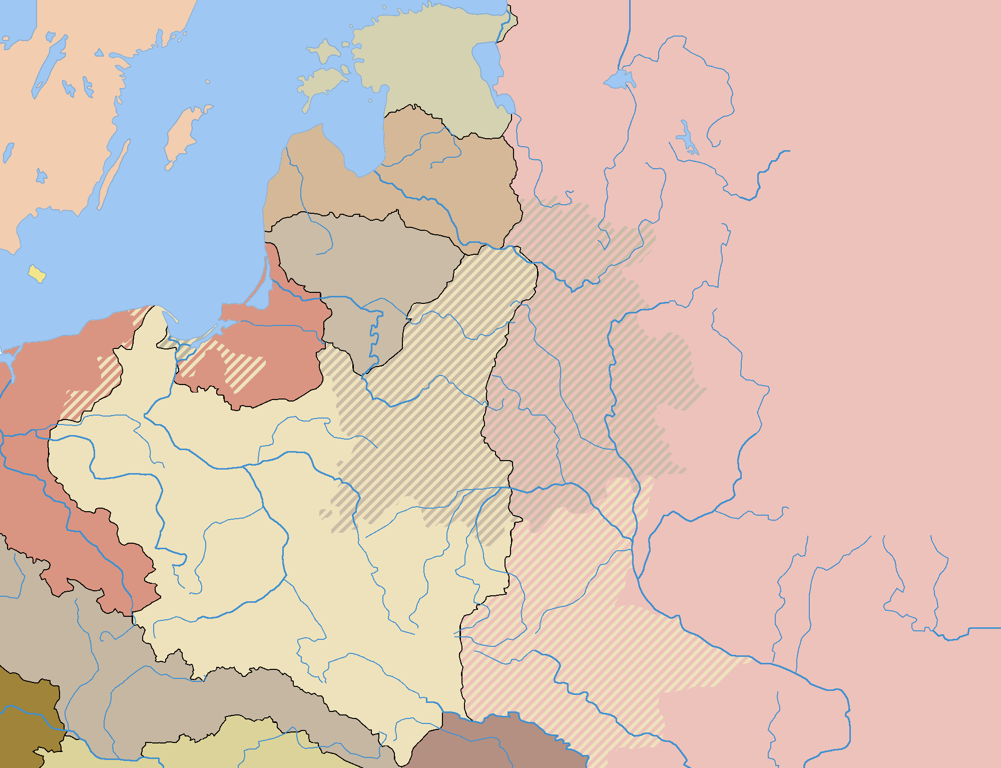
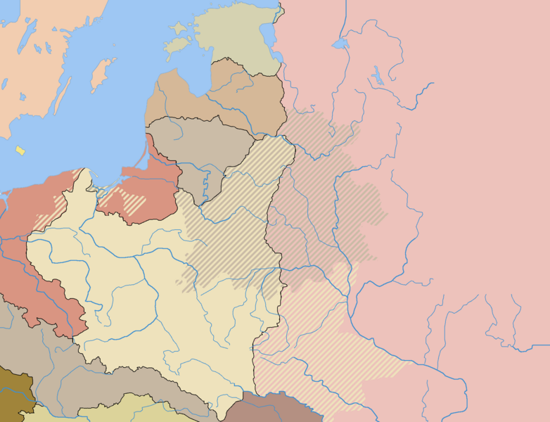
Description: The map shows the borders in Central Europe after the Polish-Bolshevik War (as of 1922). The areas marked with lines had been part of the Polish-Lithuanian Commonwealth and then Poland prior to the partitions, and were not reclaimed by Poland or Lithuania after the World War I.
Title: Rzeczpospolita 1789-1920
Credit: See Parent images (below)
Author: User:Halibutt
Permission: Share Alike 3.0 Unported (see below)
Usage Terms: Creative Commons Attribution-Share Alike 3.0
License: CC-BY-SA-3.0
License Link: http://creativecommons.org/licenses/by-sa/3.0/
Attribution Required?: Yes
Usos del archivo
La siguiente página enlaza a este archivo:

Todo el contenido de los artículos de la Enciclopedia Kiddle (incluidas las imágenes) se puede utilizar libremente para fines personales y educativos bajo la licencia Atribución-CompartirIgual a menos que se indique lo contrario.