
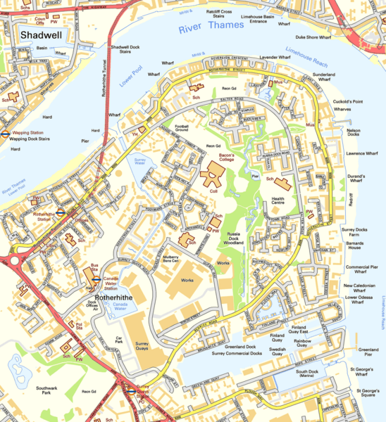
Archivo: Rotherhithe OS OpenData map

Description: Map of Rotherhithe, London
Title: Rotherhithe OS OpenData map
Credit: Ordnance Survey OpenData
Author: Ordnance Survey with modifications by Prioryman
Permission: This file is licensed under the Ordnance Survey OpenData License. In short: you are free to distribute and modify the file as long as you attribute the Ordnance Survey. Attribution: Contains Ordnance Survey data © Crown copyright and database right Note: Derivative works can be licensed under any Creative Commons Attribution 3.0 Licence. Ordnance Survey OpenData LicenceOS OpenDatahttps://www.ordnancesurvey.co.uk/business-and-government/licensing/using-creating-data-with-os-products/os-opendata.htmltrue
Usage Terms: Ordnance Survey OpenData Licence
License: OS OpenData
License Link: https://www.ordnancesurvey.co.uk/business-and-government/licensing/using-creating-data-with-os-products/os-opendata.html
Attribution Required?: Yes
Usos del archivo
La siguiente página enlaza a este archivo:
