
Archivo: Rogers Pass (NHSC chart)
No disponible en mayor resolución.
Rogers_Pass_(NHSC_chart).jpg (513 × 365 píxeles; tamaño de archivo: 176 KB; tipo MIME: image/jpeg)
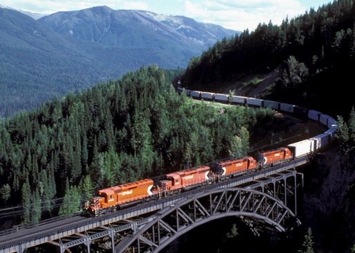
Description: The Stoney Creek Bridge is just within the East end of Glacier Park on the Connaught track between Rogers and Flat Creek on the Mountain Sub of the Revelstoke Division of the CPR. Stoney Creek Bridge is over 600' long and 325' above the creek.
Title: Rogers Pass (NHSC chart)
Credit: Crop of File:Eastbound over SCB.jpg
Author: Photograph by David R. Spencer. Please retain this attribution.
Usage Terms: Creative Commons Attribution-Share Alike 3.0
License: CC-BY-SA-3.0
License Link: http://creativecommons.org/licenses/by-sa/3.0/
Attribution Required?: Yes
Usos del archivo
La siguiente página enlaza a este archivo:
.jpg&oldid=1521218)

Todo el contenido de los artículos de la Enciclopedia Kiddle (incluidas las imágenes) se puede utilizar libremente para fines personales y educativos bajo la licencia Atribución-CompartirIgual a menos que se indique lo contrario.
.jpg)