
Archivo: River Ouse heading south, Lewes - geograph.org.uk - 77741
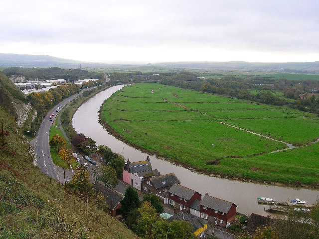
Descripción: River Ouse heading south, Lewes. Taken from Cliffe Hill looking south. The Snowdrop Inn 77727 is the yellow building at the centre bottom of the photograph following the course of the former A26. The current A26 is heading south having just left Cuilfail Tunnel that goes directly underneath the photographer. To the right is the Railway Land Nature Reserve whose western border is marked by a line of bushes which itself masks the railway line heading into Lewes. To the left is the former Southerham Chalk Pits now home to Cliffe Industrial Estate. Prior to that it was a breakers yard and was the graveyard for all of Brighton's trolley buses when they were decommissioned in the early 1960s. The end of the square is just beyond Lewes bypass which can just be made out after the Ouse swings to the right.
Título: River Ouse heading south, Lewes - geograph.org.uk - 77741
Créditos: From geograph.org.uk
Autor(a): Simon Carey
Términos de Uso: Creative Commons Attribution-Share Alike 2.0
Licencia: CC BY-SA 2.0
Enlace de Licencia: https://creativecommons.org/licenses/by-sa/2.0
¿Se exige la atribución?: Sí
Usos del archivo
No hay páginas que enlacen a esta imagen.
