
Archivo: River Brent at Brent Cross - geograph.org.uk - 1738558
No disponible en mayor resolución.
River_Brent_at_Brent_Cross_-_geograph.org.uk_-_1738558.jpg (640 × 480 píxeles; tamaño de archivo: 98 KB; tipo MIME: image/jpeg)
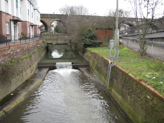
Description: River Brent at Brent Cross The Ordnance Survey 1:50,000 scale mapping shows a sea of dark green here as the A406 North Circular Road and the A41 Hendon Way meet at the Brent Cross Flyover, so you'll have to take my word for it that this is where the river is too. A small weir impounds a head of water as the river flows down towards the Brent Reservoir.
Title: River Brent at Brent Cross - geograph.org.uk - 1738558
Credit: From geograph.org.uk
Author: Nigel Cox
Usage Terms: Creative Commons Attribution-Share Alike 2.0
License: CC BY-SA 2.0
License Link: https://creativecommons.org/licenses/by-sa/2.0
Attribution Required?: Yes
Usos del archivo
La siguiente página enlaza a este archivo:

Todo el contenido de los artículos de la Enciclopedia Kiddle (incluidas las imágenes) se puede utilizar libremente para fines personales y educativos bajo la licencia Atribución-CompartirIgual a menos que se indique lo contrario.