
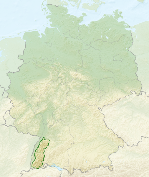
Archivo: Relief Map of Germany, Black Forest

Tamaño de esta previsualización: 506 × 600 píxeles. Otras resoluciones: 202 × 240 píxeles | 1000 × 1185 píxeles.
Archivo original (1000 × 1185 píxeles; tamaño de archivo: 1,48 MB; tipo MIME: image/png)
Descripción: Relief map of Germany with outlines of the Black Forest. Equirectangular projection, N/S stretching 150 %. Geographic limits of the map: * N: 55.1° N * S: 47.2° N * W: 5.5° E * E: 15.5° E
Título: Relief Map of Germany, Black Forest
Créditos: Este archivo deriva de: Relief Map of Germany.png: Deutschland Naturraeumliche Grossregionen.png:
Autor(a): Relief_Map_of_Germany.png: derivative work Виктор_В Deutschland_Naturraeumliche_Grossregionen.png: NordNordWest, shading by Lencer derivative work: Sitacuisses
Términos de Uso: Creative Commons Attribution-Share Alike 3.0
Licencia: CC BY-SA 3.0
Enlace de Licencia: https://creativecommons.org/licenses/by-sa/3.0
¿Se exige la atribución?: Sí
Usos del archivo
La siguiente página enlaza a este archivo:

Todo el contenido de los artículos de la Enciclopedia Kiddle (incluidas las imágenes) se puede utilizar libremente para fines personales y educativos bajo la licencia Atribución-CompartirIgual a menos que se indique lo contrario.