
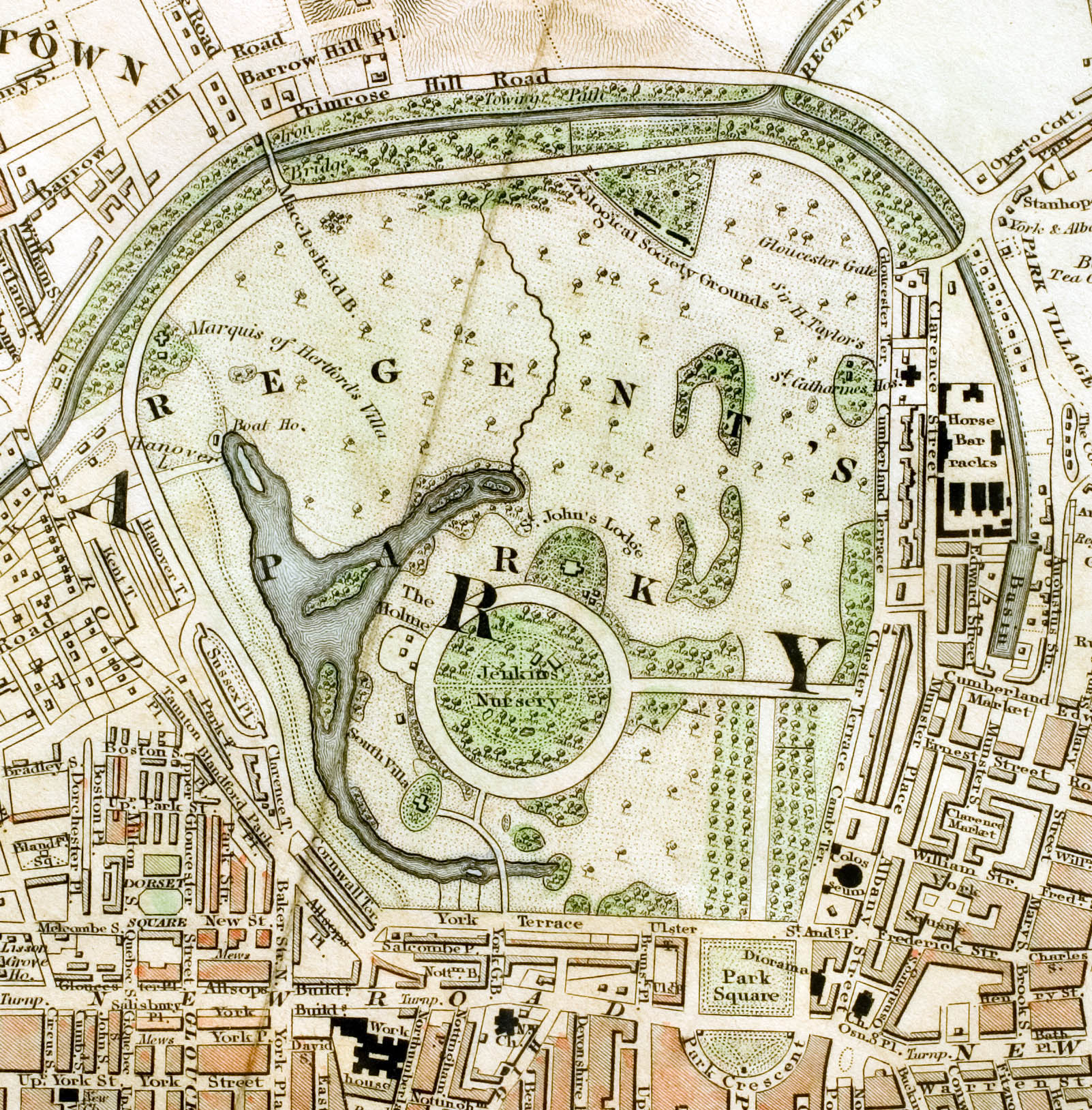
Archivo: Regent's Park London from 1833 Schmollinger map
Tamaño de esta previsualización: 590 × 600 píxeles. Otras resoluciones: 236 × 240 píxeles | 1602 × 1628 píxeles.
Archivo original (1602 × 1628 píxeles; tamaño de archivo: 801 KB; tipo MIME: image/jpeg)
Description: Regent's Park section of "Improved map of London for 1833, from Actual Survey. Engraved by W. Schmollinger, 27 Goswell Terrace", photographed for Wikipedia by User:Pointillist. All rights of the photographer are hereby released. The grey fold mark represents the vertical orientation of the original map.
Title: Regent's Park London from 1833 Schmollinger map
Credit: Improved map of London
Author: W. Schmollinger
Usage Terms: Public domain
License: Public domain
Attribution Required?: No
Usos del archivo
La siguiente página enlaza a este archivo:

Todo el contenido de los artículos de la Enciclopedia Kiddle (incluidas las imágenes) se puede utilizar libremente para fines personales y educativos bajo la licencia Atribución-CompartirIgual a menos que se indique lo contrario.