
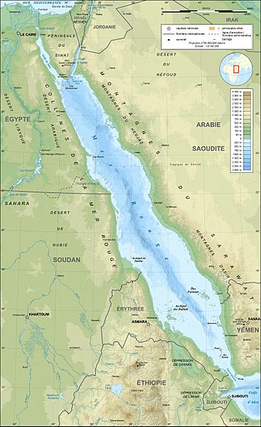
Archivo: Red Sea topographic map-fr

Descripción: Topographic / bathymetric map in French of the Red Sea, UTM projection (WGS84 datum). Note : for translation purpose, use the SVG version.
Título: Red Sea topographic map-fr
Créditos: Own work (see complete description on Image:Red_Sea_topographic_map-fr.svg)
Autor(a): Eric Gaba (Sting - fr:Sting)
Permiso: Attribution and Share-Alike required Any use of this map can be made as long as you credit me (Eric Gaba – Wikimedia Commons user: Sting) as the author and distribute the copies and derivative works under the same license(s) that the one(s) stated below. A message with a reply address would also be greatly appreciated.
Términos de Uso: Creative Commons Attribution-Share Alike 4.0
Licencia: CC BY-SA 4.0
Enlace de Licencia: https://creativecommons.org/licenses/by-sa/4.0
¿Se exige la atribución?: Sí
Usos del archivo
La siguiente página enlaza a este archivo:
