
Archivo: Radar coverage from ground level
Tamaño de esta previsualización: 800 × 419 píxeles. Otras resoluciones: 320 × 168 píxeles | 958 × 502 píxeles.
Archivo original (958 × 502 píxeles; tamaño de archivo: 203 KB; tipo MIME: image/png)
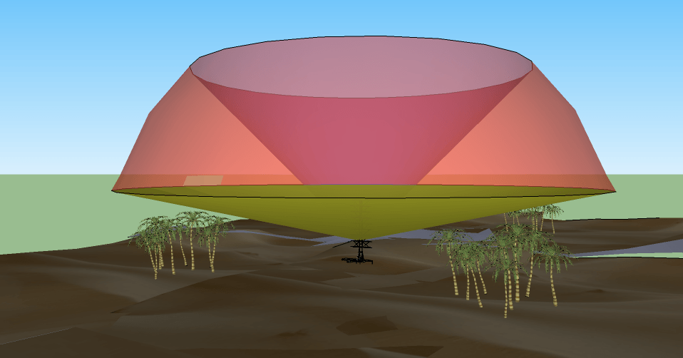
Description: A simple 3D diagram (from Google Sketch) showing a representative radar coverage pattern. The rounded surface is the maximum range of the system (which may be "soft"), the lower limit is selected to avoid reflections from the ground, and the upper surface is the maximum angle, a factor of the antenna design.
Title: Radar coverage from ground level
Credit: Own work
Author: Maury Markowitz
Usage Terms: Creative Commons Attribution-Share Alike 3.0
License: CC BY-SA 3.0
License Link: http://creativecommons.org/licenses/by-sa/3.0
Attribution Required?: Yes
Usos del archivo
La siguiente página enlaza a este archivo:

Todo el contenido de los artículos de la Enciclopedia Kiddle (incluidas las imágenes) se puede utilizar libremente para fines personales y educativos bajo la licencia Atribución-CompartirIgual a menos que se indique lo contrario.