
Archivo: Quappellerivermap
No disponible en mayor resolución.
Quappellerivermap.png (500 × 499 píxeles; tamaño de archivo: 137 KB; tipo MIME: image/png)
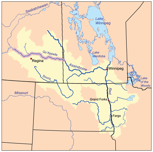
Description: This is a map of the Red River of the North drainage basin, with the Qu'Appelle River highlighted. I, Karl Musser, created it based on USGS and Digital Chart of the World data.
Title: Quappellerivermap
Credit: No machine-readable source provided. Own work assumed (based on copyright claims).
Author: No machine-readable author provided. Kmusser assumed (based on copyright claims).
Usage Terms: Creative Commons Attribution-Share Alike 2.5
License: CC BY-SA 2.5
License Link: https://creativecommons.org/licenses/by-sa/2.5
Attribution Required?: Yes
Usos del archivo
La siguiente página enlaza a este archivo:

Todo el contenido de los artículos de la Enciclopedia Kiddle (incluidas las imágenes) se puede utilizar libremente para fines personales y educativos bajo la licencia Atribución-CompartirIgual a menos que se indique lo contrario.